
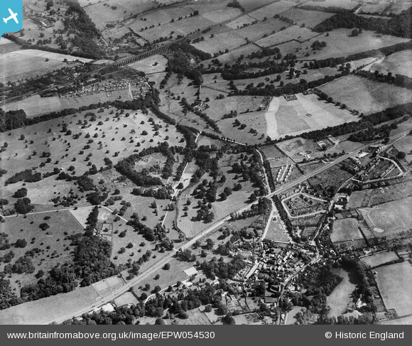
EPW054530 ENGLAND (1937). The village and surrounding countryside, Welwyn, 1937
© Copyright OpenStreetMap contributors and licensed by the OpenStreetMap Foundation. 2025. Cartography is licensed as CC BY-SA.
Nearby Images (3)
EPW054530

EPW054529

EPW054512

Details
| Title | [EPW054530] The village and surrounding countryside, Welwyn, 1937 |
| Reference | EPW054530 |
| Date | 30-July-1937 |
| Link | |
| Place name | WELWYN |
| Parish | WELWYN |
| District | |
| Country | ENGLAND |
| Easting / Northing | 523622, 215769 |
| Longitude / Latitude | -0.2059461066943, 51.826398597066 |
| National Grid Reference | TL236158 |
Pins
 Chells809 |
Tuesday 22nd of August 2017 10:01:25 PM | |
Chells809 |
Thursday 2nd of January 2014 09:43:19 PM | |
Chells809 |
Monday 21st of October 2013 10:03:29 PM | |
Chells809 |
Monday 21st of October 2013 10:02:13 PM | |
Chells809 |
Monday 21st of October 2013 10:00:51 PM | |
Chells809 |
Monday 21st of October 2013 09:59:23 PM | |
Chells809 |
Monday 21st of October 2013 09:58:20 PM | |
Chells809 |
Monday 21st of October 2013 09:57:06 PM | |
Chells809 |
Monday 21st of October 2013 09:54:29 PM | |
Chells809 |
Monday 21st of October 2013 09:53:18 PM | |
Chells809 |
Monday 21st of October 2013 09:51:58 PM | |
Chells809 |
Monday 21st of October 2013 09:49:49 PM | |
Chells809 |
Monday 21st of October 2013 09:47:23 PM | |
NAM2505 |
Sunday 23rd of June 2013 04:48:39 AM | |
NAM2505 |
Sunday 23rd of June 2013 04:48:03 AM | |
NAM2505 |
Sunday 23rd of June 2013 04:47:38 AM |