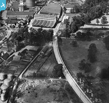
EPW058773 ENGLAND (1938). Landseer Road, Holywells Road and environs, Ipswich, 1938
© Copyright OpenStreetMap contributors and licensed by the OpenStreetMap Foundation. 2025. Cartography is licensed as CC BY-SA.
Nearby Images (9)
Details
| Title | [EPW058773] Landseer Road, Holywells Road and environs, Ipswich, 1938 |
| Reference | EPW058773 |
| Date | 23-August-1938 |
| Link | |
| Place name | IPSWICH |
| Parish | |
| District | |
| Country | ENGLAND |
| Easting / Northing | 617185, 243137 |
| Longitude / Latitude | 1.1674040518602, 52.043589718423 |
| National Grid Reference | TM172431 |
Pins
 Where's Canning Town? |
Saturday 31st of October 2015 09:11:24 PM |
User Comment Contributions
 Where's Canning Town? |
Saturday 31st of October 2015 09:10:33 PM |


![[EPW058773] Landseer Road, Holywells Road and environs, Ipswich, 1938](http://britainfromabove.org.uk/sites/all/libraries/aerofilms-images/public/100x100/EPW/058/EPW058773.jpg)
![[EPW058771] Landseer Road, Holywells Road and environs, Ipswich, 1938](http://britainfromabove.org.uk/sites/all/libraries/aerofilms-images/public/100x100/EPW/058/EPW058771.jpg)
![[EAW033330] Ipswich Dock, New Cut and the town, Ipswich, from the south-east, 1950](http://britainfromabove.org.uk/sites/all/libraries/aerofilms-images/public/100x100/EAW/033/EAW033330.jpg)
![[EPW058770] The Esso Oil Storage Depot and Landseer Road, Ipswich, 1938](http://britainfromabove.org.uk/sites/all/libraries/aerofilms-images/public/100x100/EPW/058/EPW058770.jpg)
![[EPW058772] Landseer Road, Ipswich, 1938](http://britainfromabove.org.uk/sites/all/libraries/aerofilms-images/public/100x100/EPW/058/EPW058772.jpg)
![[EPW032850] Holywells Park and the docks, Ipswich, 1930](http://britainfromabove.org.uk/sites/all/libraries/aerofilms-images/public/100x100/EPW/032/EPW032850.jpg)
![[EPW032835] The docks and the town, Ipswich, from the south-east, 1930](http://britainfromabove.org.uk/sites/all/libraries/aerofilms-images/public/100x100/EPW/032/EPW032835.jpg)
![[EPW001825] Ipswich Wharves, Wet Dock and Lock, Ipswich, 1920](http://britainfromabove.org.uk/sites/all/libraries/aerofilms-images/public/100x100/EPW/001/EPW001825.jpg)
![[EAW025121] Gabriel, Wade and English Timber Yard and the River Orwell looking along Wet Dock, Ipswich, 1949. This image was marked by Aerofilms Ltd for photo editing.](http://britainfromabove.org.uk/sites/all/libraries/aerofilms-images/public/100x100/EAW/025/EAW025121.jpg)
