
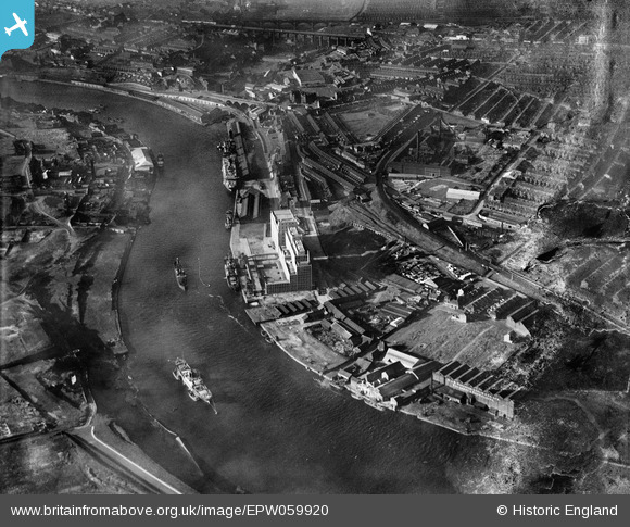
EPW059920 ENGLAND (1938). The Tyne Flour Mill, the River Tyne and the Quayside, Newcastle Upon Tyne, 1938. This image has been produced from a damaged negative.
© Copyright OpenStreetMap contributors and licensed by the OpenStreetMap Foundation. 2025. Cartography is licensed as CC BY-SA.
Nearby Images (12)
EPW059920

EPW062213

EPW062212

EPW059921

EPW059919

EPW059923

EAW037005
 moored on the River Tyne near the Tyne Mill, Byker, 1951. This image has been produced from a print.")
EAW037003
 moored on the River Tyne opposite the South Shore Road Engineering Works, Byker, 1951. This image has been produced from a print.")
EPW059922

EAW037007
 moored on the River Tyne and the area around St Lawrence Park, Byker, 1951. This image has been produced from a print.")
EAW037006
 moored on the River Tyne, Byker, 1951. This image has been produced from a print.")
EAW037004
 moored on the River Tyne near the Tyne Mill, Byker, 1951. This image has been produced from a print.")
Details
| Title | [EPW059920] The Tyne Flour Mill, the River Tyne and the Quayside, Newcastle Upon Tyne, 1938. This image has been produced from a damaged negative. |
| Reference | EPW059920 |
| Date | 11-October-1938 |
| Link | |
| Place name | NEWCASTLE UPON TYNE |
| Parish | |
| District | |
| Country | ENGLAND |
| Easting / Northing | 426952, 563714 |
| Longitude / Latitude | -1.5789687302449, 54.967244190927 |
| National Grid Reference | NZ270637 |
Pins
 Nevets49 |
Saturday 9th of January 2021 06:58:56 PM | |
Nevets49 |
Saturday 9th of January 2021 06:54:53 PM | |
avocet |
Tuesday 25th of March 2014 05:23:32 PM | |
this should have been Albion Row and not Street |
avocet |
Wednesday 26th of March 2014 10:28:30 AM |
avocet |
Tuesday 25th of March 2014 05:08:42 PM | |
avocet |
Tuesday 25th of March 2014 05:04:20 PM |