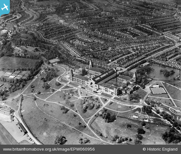
EPW060956 ENGLAND (1939). Alexandra Palace and environs, Alexandra Palace, 1939
© Copyright OpenStreetMap contributors and licensed by the OpenStreetMap Foundation. 2025. Cartography is licensed as CC BY-SA.
Nearby Images (21)
EPW060956

EAW015854

EPW005788

EAW022329

EPW024780

EPW005787

EPW046814

EAW003047

EPW005590

EPW024778

EPW024779

EPW046818

EPW005789

EPW046809

EAW022328

EPW026945

EPW046811

EPW008882

EPW006283

EPW046812

EPW026944

Details
| Title | [EPW060956] Alexandra Palace and environs, Alexandra Palace, 1939 |
| Reference | EPW060956 |
| Date | 12-May-1939 |
| Link | |
| Place name | ALEXANDRA PALACE |
| Parish | |
| District | |
| Country | ENGLAND |
| Easting / Northing | 529495, 189992 |
| Longitude / Latitude | -0.13034173696308, 51.593400590321 |
| National Grid Reference | TQ295900 |
Pins
 Billy Turner |
Wednesday 30th of December 2015 09:05:56 PM | |
 gBr |
Friday 26th of December 2014 01:35:26 AM | |
Robin |
Monday 16th of June 2014 01:16:47 AM | |
 Alan McFaden |
Friday 23rd of August 2013 06:37:58 PM |