
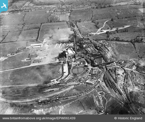
EPW061439 ENGLAND (1939). Chatterley Whitfield Colliery, Whitfield, 1939
© Copyright OpenStreetMap contributors and licensed by the OpenStreetMap Foundation. 2025. Cartography is licensed as CC BY-SA.
Nearby Images (7)
EPW061439

EPW061445

EPW061436

EPW061442

EPW061443

EPW061438

EPW061440

Details
| Title | [EPW061439] Chatterley Whitfield Colliery, Whitfield, 1939 |
| Reference | EPW061439 |
| Date | 1-June-1939 |
| Link | |
| Place name | WHITFIELD |
| Parish | |
| District | |
| Country | ENGLAND |
| Easting / Northing | 388324, 353249 |
| Longitude / Latitude | -2.1743052850565, 53.076042924048 |
| National Grid Reference | SJ883532 |
Pins
 IvanSherratt |
Sunday 15th of September 2013 02:41:10 PM | |
 bescotbeast |
Friday 13th of September 2013 11:47:52 AM |