
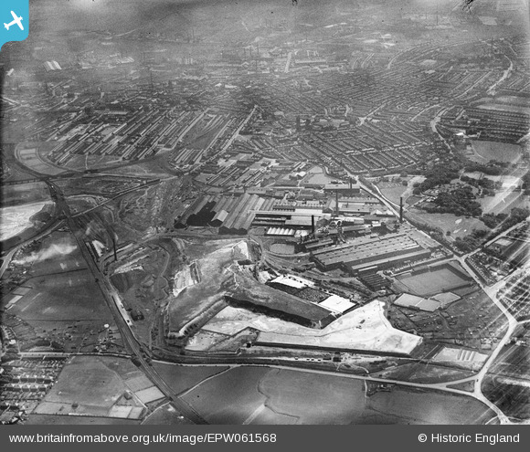
EPW061568 ENGLAND (1939). The Gerard's Bridge Plate Glass Works and environs, St Helens, 1939
© Copyright OpenStreetMap contributors and licensed by the OpenStreetMap Foundation. 2025. Cartography is licensed as CC BY-SA.
Nearby Images (22)
EPW061568

EAW012390

EPW009318

EPW009312

EPW061564

EPW061563

EPW061565

EAW013757

EPW061569

EAW013754

EPW061567

EAW013770

EPW061566

EAW012393

EPW061570

EAW012387

EAW013768

EPW009316

EPW009317

EPW009311

EPW061571

EAW013763

Details
| Title | [EPW061568] The Gerard's Bridge Plate Glass Works and environs, St Helens, 1939 |
| Reference | EPW061568 |
| Date | 4-June-1939 |
| Link | |
| Place name | ST HELENS |
| Parish | |
| District | |
| Country | ENGLAND |
| Easting / Northing | 351150, 396537 |
| Longitude / Latitude | -2.7358786044847, 53.463055492865 |
| National Grid Reference | SJ512965 |
Pins
 pauloyick |
Tuesday 7th of January 2014 07:33:18 PM |