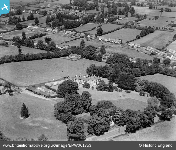
EPW061753 ENGLAND (1939). Woodfield House and environs, Kingswinford, 1939
© Copyright OpenStreetMap contributors and licensed by the OpenStreetMap Foundation. 2025. Cartography is licensed as CC BY-SA.
Nearby Images (6)
Details
| Title | [EPW061753] Woodfield House and environs, Kingswinford, 1939 |
| Reference | EPW061753 |
| Date | 10-June-1939 |
| Link | |
| Place name | KINGSWINFORD |
| Parish | |
| District | |
| Country | ENGLAND |
| Easting / Northing | 388510, 287325 |
| Longitude / Latitude | -2.1692140994364, 52.483356433138 |
| National Grid Reference | SO885873 |
Pins
Be the first to add a comment to this image!


![[EPW061753] Woodfield House and environs, Kingswinford, 1939](http://britainfromabove.org.uk/sites/all/libraries/aerofilms-images/public/100x100/EPW/061/EPW061753.jpg)
![[EPW061751] Woodfield House, Kingswinford, 1939](http://britainfromabove.org.uk/sites/all/libraries/aerofilms-images/public/100x100/EPW/061/EPW061751.jpg)
![[EPW061750] Woodfield House, Kingswinford, 1939](http://britainfromabove.org.uk/sites/all/libraries/aerofilms-images/public/100x100/EPW/061/EPW061750.jpg)
![[EPW061754] Woodfield House and environs, Kingswinford, 1939](http://britainfromabove.org.uk/sites/all/libraries/aerofilms-images/public/100x100/EPW/061/EPW061754.jpg)
![[EPW061752] Woodfield House and environs, Kingswinford, 1939](http://britainfromabove.org.uk/sites/all/libraries/aerofilms-images/public/100x100/EPW/061/EPW061752.jpg)
![[EPW061755] Woodfield House, Cot Lane and environs, Kingswinford, 1939](http://britainfromabove.org.uk/sites/all/libraries/aerofilms-images/public/100x100/EPW/061/EPW061755.jpg)