
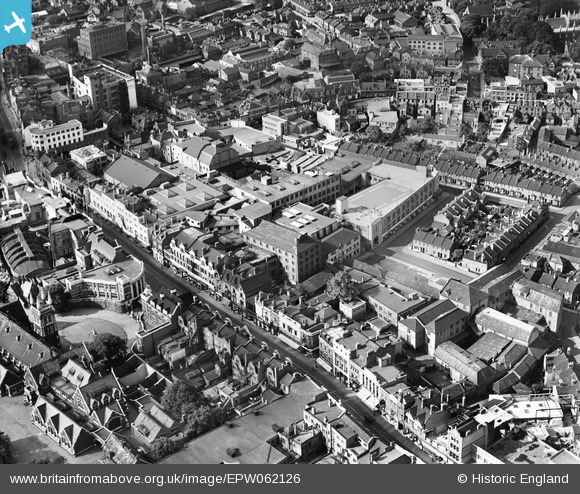
EPW062126 ENGLAND (1939). North End, Croydon, 1939
© Copyright OpenStreetMap contributors and licensed by the OpenStreetMap Foundation. 2025. Cartography is licensed as CC BY-SA.
Nearby Images (9)
EPW062126

EPW062127

EPW062130

EPW062129

EPW062131

EPW062128

EPW056622

EPW021425

EPW052795

Details
| Title | [EPW062126] North End, Croydon, 1939 |
| Reference | EPW062126 |
| Date | 2-July-1939 |
| Link | |
| Place name | CROYDON |
| Parish | |
| District | |
| Country | ENGLAND |
| Easting / Northing | 532224, 165688 |
| Longitude / Latitude | -0.10006570937237, 51.374332925185 |
| National Grid Reference | TQ322657 |
Pins
 Graham |
Friday 22nd of February 2019 10:09:07 PM | |
Graham |
Friday 22nd of February 2019 10:07:04 PM | |
Graham |
Friday 22nd of February 2019 10:06:06 PM | |
Graham |
Friday 22nd of February 2019 10:04:09 PM | |
Graham |
Friday 22nd of February 2019 10:01:00 PM | |
Graham |
Friday 22nd of February 2019 10:00:04 PM | |
Graham |
Friday 22nd of February 2019 09:58:40 PM | |
brianbeckett |
Thursday 16th of October 2014 10:17:26 PM |