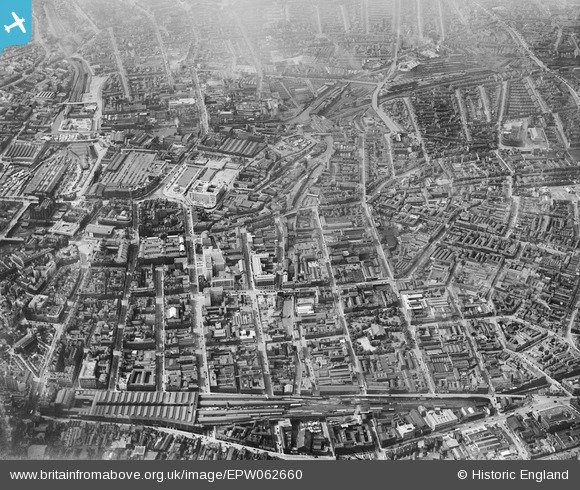
EPW062660 ENGLAND (1939). Snow Hill Station and the city centre, Birmingham, 1939
© Copyright OpenStreetMap contributors and licensed by the OpenStreetMap Foundation. 2025. Cartography is licensed as CC BY-SA.
Nearby Images (5)
Details
| Title | [EPW062660] Snow Hill Station and the city centre, Birmingham, 1939 |
| Reference | EPW062660 |
| Date | 16-August-1939 |
| Link | |
| Place name | BIRMINGHAM |
| Parish | |
| District | |
| Country | ENGLAND |
| Easting / Northing | 406358, 287135 |
| Longitude / Latitude | -1.9063687258451, 52.481732094239 |
| National Grid Reference | SP064871 |
Pins
 Ron41 |
Sunday 8th of September 2013 11:22:38 AM | |
 Ron41 |
Sunday 8th of September 2013 11:21:30 AM | |
 Ron41 |
Sunday 8th of September 2013 11:19:02 AM | |
 Ron41 |
Sunday 8th of September 2013 11:17:02 AM | |
 Ron41 |
Sunday 8th of September 2013 11:16:15 AM | |
 Ron41 |
Sunday 8th of September 2013 11:13:53 AM |


![[EPW062660] Snow Hill Station and the city centre, Birmingham, 1939](http://britainfromabove.org.uk/sites/all/libraries/aerofilms-images/public/100x100/EPW/062/EPW062660.jpg)
![[EPW057483] The Hall of Memory, Baskerville House under construction and the city, Birmingham, from the south, 1938](http://britainfromabove.org.uk/sites/all/libraries/aerofilms-images/public/100x100/EPW/057/EPW057483.jpg)
![[EPW053101] Great Charles Street, Lionel Street and environs, Birmingham, 1937](http://britainfromabove.org.uk/sites/all/libraries/aerofilms-images/public/100x100/EPW/053/EPW053101.jpg)
![[EPW022585] The Hall of Memory, Birmingham, 1928](http://britainfromabove.org.uk/sites/all/libraries/aerofilms-images/public/100x100/EPW/022/EPW022585.jpg)
![[EPW005850] The Town Hall on Victoria Square and environs, Birmingham, 1921. This image has been produced from a print.](http://britainfromabove.org.uk/sites/all/libraries/aerofilms-images/public/100x100/EPW/005/EPW005850.jpg)