
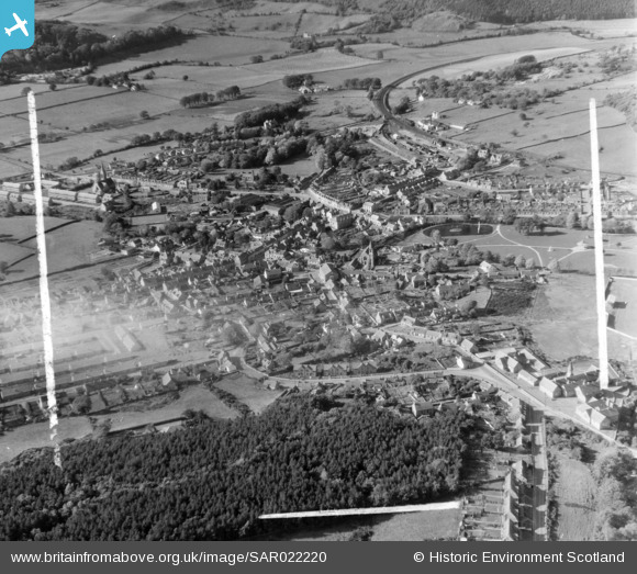
SAR022220 SCOTLAND (1954). Dalbeattie Urr, Kirkcudbrightshire, Scotland. An oblique aerial photograph taken facing West. This image was marked by AeroPictorial Ltd for photo editing.
© Copyright OpenStreetMap contributors and licensed by the OpenStreetMap Foundation. 2025. Cartography is licensed as CC BY-SA.
Nearby Images (5)
SAR020720

SAR020721

SAR022220

SAR022221

SAR022222

Details
| Title | [SAR022220] Dalbeattie Urr, Kirkcudbrightshire, Scotland. An oblique aerial photograph taken facing West. This image was marked by AeroPictorial Ltd for photo editing. |
| Reference | SAR022220 |
| Date | 1954 |
| Link | Canmore Collection item 1438325 |
| Place name | |
| Parish | URR |
| District | STEWARTRY |
| Country | SCOTLAND |
| Easting / Northing | 283410, 561240 |
| Longitude / Latitude | -3.8198239808452, 54.932116662651 |
| National Grid Reference | NX834612 |
Pins
 Karhedron |
Friday 14th of January 2022 01:51:22 PM |