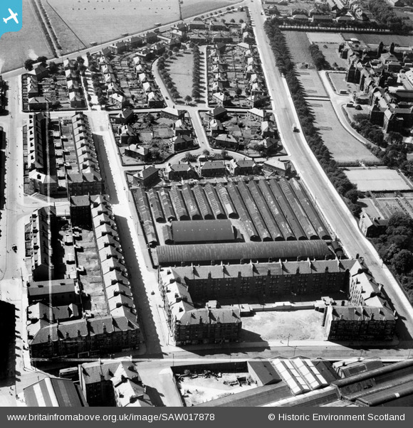
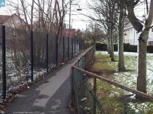
SAW017878 SCOTLAND (1948). Glasgow, general view, showing Arbuckle Smith and Co. Warehouse, Moss Road and Burghead Drive. An oblique aerial photograph taken facing south. This image has been produced from a crop marked negative.
© Copyright OpenStreetMap contributors and licensed by the OpenStreetMap Foundation. 2025. Cartography is licensed as CC BY-SA.
Nearby Images (5)
Details
| Title | [SAW017878] Glasgow, general view, showing Arbuckle Smith and Co. Warehouse, Moss Road and Burghead Drive. An oblique aerial photograph taken facing south. This image has been produced from a crop marked negative. |
| Reference | SAW017878 |
| Date | 1948 |
| Link | Canmore Collection item 1269101 |
| Place name | |
| Parish | GOVAN (CITY OF GLASGOW) |
| District | CITY OF GLASGOW |
| Country | SCOTLAND |
| Easting / Northing | 254013, 665828 |
| Longitude / Latitude | -4.3329935452184, 55.863518388384 |
| National Grid Reference | NS540658 |
Pins
 Kieran Goddard |
Thursday 3rd of February 2022 04:11:41 PM | |
 redmist |
Friday 8th of January 2021 01:38:44 PM | |
 redmist |
Friday 8th of January 2021 01:37:15 PM | |
 Acumfaegovan |
Monday 25th of March 2013 12:34:39 AM |


![[SAW017875] Glasgow, general view, showing Arbuckle Smith and Co. Warehouse, Moss Road and Southern General Hospital. An oblique aerial photograph taken facing north. This image has been produced from a crop marked negative.](http://britainfromabove.org.uk/sites/all/libraries/aerofilms-images/public/100x100/SAW/017/SAW017875.jpg)
![[SAW017876] Glasgow, general view, showing Arbuckle Smith and Co. Warehouse, Moss Road and River Clyde. An oblique aerial photograph taken facing north-east. This image has been produced from a crop marked negative.](http://britainfromabove.org.uk/sites/all/libraries/aerofilms-images/public/100x100/SAW/017/SAW017876.jpg)
![[SAW017877] Glasgow, general view, showing Arbuckle Smith and Co. Warehouse, Moss Road and Southern General Hospital. An oblique aerial photograph taken facing west. This image has been produced from a crop marked negative.](http://britainfromabove.org.uk/sites/all/libraries/aerofilms-images/public/100x100/SAW/017/SAW017877.jpg)
![[SAW017878] Glasgow, general view, showing Arbuckle Smith and Co. Warehouse, Moss Road and Burghead Drive. An oblique aerial photograph taken facing south. This image has been produced from a crop marked negative.](http://britainfromabove.org.uk/sites/all/libraries/aerofilms-images/public/100x100/SAW/017/SAW017878.jpg)
![[SAR016593] Southern General Hospital Govan, Lanarkshire, Scotland. An oblique aerial photograph taken facing North.](http://britainfromabove.org.uk/sites/all/libraries/aerofilms-images/public/100x100/SAR/016/SAR016593.jpg)
