
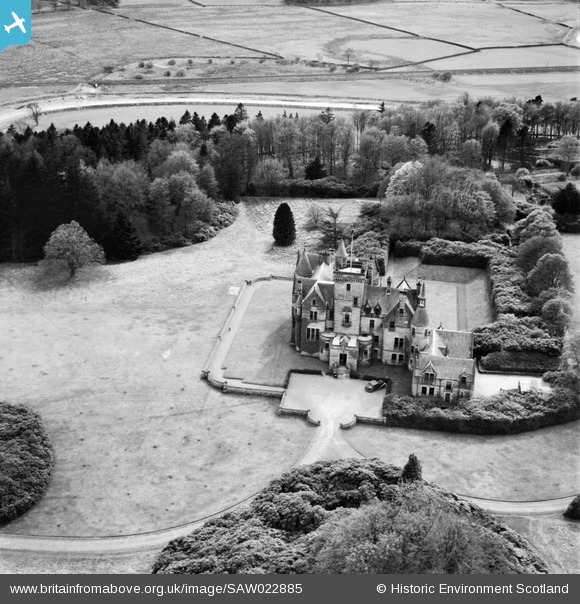
SAW022885 SCOTLAND (1949). Crawfordton House School, Moniaive. An oblique aerial photograph taken facing south.
© Copyright OpenStreetMap contributors and licensed by the OpenStreetMap Foundation. 2025. Cartography is licensed as CC BY-SA.
Nearby Images (4)
SAW022884

SAW022885

SAW022886

SAW022887

Details
| Title | [SAW022885] Crawfordton House School, Moniaive. An oblique aerial photograph taken facing south. |
| Reference | SAW022885 |
| Date | 1949 |
| Link | Canmore Collection item 1269236 |
| Place name | |
| Parish | GLENCAIRN |
| District | NITHSDALE |
| Country | SCOTLAND |
| Easting / Northing | 279626, 590592 |
| Longitude / Latitude | -3.891246819652, 55.194865667946 |
| National Grid Reference | NX796906 |
Pins
 |
 Billy Turner |
Sunday 28th of February 2016 10:19:26 PM |