
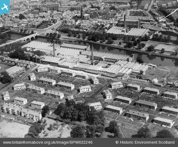
SPW022246 SCOTLAND (1928). Dumfries, general view, showing Rosefield Mills and Nithsdale Mills. An oblique aerial photograph taken facing north-east.
© Copyright OpenStreetMap contributors and licensed by the OpenStreetMap Foundation. 2025. Cartography is licensed as CC BY-SA.
Nearby Images (5)
SPW022242

SPW022246

SPW022244

SPW022250

SPW042489

Details
| Title | [SPW022246] Dumfries, general view, showing Rosefield Mills and Nithsdale Mills. An oblique aerial photograph taken facing north-east. |
| Reference | SPW022246 |
| Date | 1928 |
| Link | Canmore Collection item 1256560 |
| Place name | |
| Parish | TROQUEER (DUMFRIES-SHIRE) |
| District | NITHSDALE |
| Country | SCOTLAND |
| Easting / Northing | 297347, 575461 |
| Longitude / Latitude | -3.6074867751271, 55.062935021794 |
| National Grid Reference | NX973755 |
Pins
Be the first to add a comment to this image!