
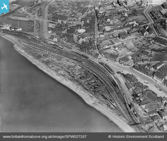
SPW027167 SCOTLAND (1929). Bo'ness, general view, showing Bo'ness Station and South Street. An oblique aerial photograph taken facing east.
© Copyright OpenStreetMap contributors and licensed by the OpenStreetMap Foundation. 2025. Cartography is licensed as CC BY-SA.
Nearby Images (5)
SPW027167

SPW027159

SPW027165

SPW027158

SPW020279

Details
| Title | [SPW027167] Bo'ness, general view, showing Bo'ness Station and South Street. An oblique aerial photograph taken facing east. |
| Reference | SPW027167 |
| Date | 1929 |
| Link | Canmore Collection item 1256741 |
| Place name | |
| Parish | BO'NESS AND CARRIDEN |
| District | FALKIRK |
| Country | SCOTLAND |
| Easting / Northing | 299734, 681633 |
| Longitude / Latitude | -3.6086039691521, 56.017161808927 |
| National Grid Reference | NS997816 |
