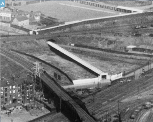
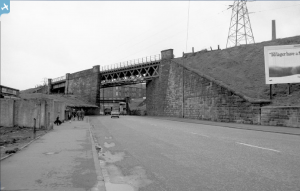
SPW040336 SCOTLAND (1932). Carntyne Greyhound Racecourse, Myreside Street, Glasgow. An oblique aerial photograph taken facing west.
© Copyright OpenStreetMap contributors and licensed by the OpenStreetMap Foundation. 2025. Cartography is licensed as CC BY-SA.
Nearby Images (8)
Details
| Title | [SPW040336] Carntyne Greyhound Racecourse, Myreside Street, Glasgow. An oblique aerial photograph taken facing west. |
| Reference | SPW040336 |
| Date | 1932 |
| Link | Canmore Collection item 1257393 |
| Place name | |
| Parish | GLASGOW (CITY OF GLASGOW) |
| District | CITY OF GLASGOW |
| Country | SCOTLAND |
| Easting / Northing | 262694, 664747 |
| Longitude / Latitude | -4.1938345692159, 55.856362030441 |
| National Grid Reference | NS627647 |
Pins
 Billy Turner |
Monday 10th of November 2014 07:15:38 PM | |
 Billy Turner |
Monday 10th of November 2014 07:02:44 PM | |
 gerry-r |
Sunday 29th of June 2014 10:37:20 PM |


![[SPW019489] Carntyne Greyhound Racecourse, Myreside Street, Glasgow. An oblique aerial photograph taken facing west.](http://britainfromabove.org.uk/sites/all/libraries/aerofilms-images/public/100x100/SPW/019/SPW019489.jpg)
![[SPW040335] Carntyne Greyhound Racecourse, Myreside Street, Glasgow. An oblique aerial photograph taken facing north-west.](http://britainfromabove.org.uk/sites/all/libraries/aerofilms-images/public/100x100/SPW/040/SPW040335.jpg)
![[SPW040336] Carntyne Greyhound Racecourse, Myreside Street, Glasgow. An oblique aerial photograph taken facing west.](http://britainfromabove.org.uk/sites/all/libraries/aerofilms-images/public/100x100/SPW/040/SPW040336.jpg)
![[SPW040337] Carntyne Greyhound Racecourse, Myreside Street, Glasgow. An oblique aerial photograph taken facing north-west.](http://britainfromabove.org.uk/sites/all/libraries/aerofilms-images/public/100x100/SPW/040/SPW040337.jpg)
![[SPW040338] Carntyne Greyhound Racecourse, Myreside Street, Glasgow. An oblique aerial photograph taken facing north-west.](http://britainfromabove.org.uk/sites/all/libraries/aerofilms-images/public/100x100/SPW/040/SPW040338.jpg)
![[SPW040339] Carntyne Greyhound Racecourse, Myreside Street, Glasgow. An oblique aerial photograph taken facing west.](http://britainfromabove.org.uk/sites/all/libraries/aerofilms-images/public/100x100/SPW/040/SPW040339.jpg)
![[SPW040340] Carntyne Greyhound Racecourse, Myreside Street, Glasgow. An oblique aerial photograph taken facing west.](http://britainfromabove.org.uk/sites/all/libraries/aerofilms-images/public/100x100/SPW/040/SPW040340.jpg)
![[SPW040341] Carntyne Greyhound Racecourse, Myreside Street, Glasgow. An oblique aerial photograph taken facing north-west.](http://britainfromabove.org.uk/sites/all/libraries/aerofilms-images/public/100x100/SPW/040/SPW040341.jpg)

