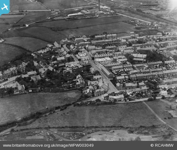
WPW003049 WALES (1920). View of Flint, oblique aerial view. 5"x4" black and white glass plate negative.
© Copyright OpenStreetMap contributors and licensed by the OpenStreetMap Foundation. 2025. Cartography is licensed as CC BY-SA.
Details
| Title | [WPW003049] View of Flint, oblique aerial view. 5"x4" black and white glass plate negative. |
| Reference | WPW003049 |
| Date | July-1920 |
| Link | Coflein Archive Item 6370282 |
| Place name | |
| Parish | |
| District | |
| Country | WALES |
| Easting / Northing | 324258, 372963 |
| Longitude / Latitude | -3.135263690701, 53.247993544058 |
| National Grid Reference | SJ243730 |
Pins
Be the first to add a comment to this image!


![[WPW003048] View of Flint, oblique aerial view. 5"x4" black and white glass plate negative.](http://britainfromabove.org.uk/sites/all/libraries/aerofilms-images/public/100x100/WPW/003/WPW003048.jpg)
![[WPW003049] View of Flint, oblique aerial view. 5"x4" black and white glass plate negative.](http://britainfromabove.org.uk/sites/all/libraries/aerofilms-images/public/100x100/WPW/003/WPW003049.jpg)
![[WPW003051] View of the North Wales Paper Company Ltd, Flint, oblique aerial view. 5"x4" black and white glass plate negative.](http://britainfromabove.org.uk/sites/all/libraries/aerofilms-images/public/100x100/WPW/003/WPW003051.jpg)
![[WPW003055] View of Flint, oblique aerial view. 5"x4" black and white glass plate negative.](http://britainfromabove.org.uk/sites/all/libraries/aerofilms-images/public/100x100/WPW/003/WPW003055.jpg)
![[WPW003056] View of Flint showing the Courtaulds factory, oblique aerial view. 5"x4" black and white glass plate negative.](http://britainfromabove.org.uk/sites/all/libraries/aerofilms-images/public/100x100/WPW/003/WPW003056.jpg)