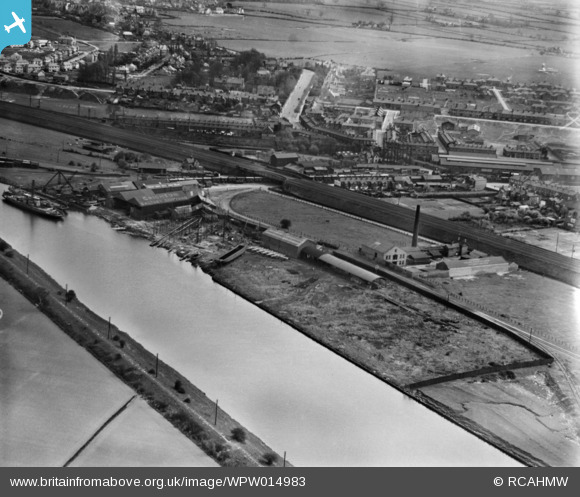
WPW014983 WALES (1926). View of Crichton's shipyard, Saltney, oblique aerial view. 5"x4" black and white glass plate negative.
© Copyright OpenStreetMap contributors and licensed by the OpenStreetMap Foundation. 2024. Cartography is licensed as CC BY-SA.
Details
| Title | [WPW014983] View of Crichton's shipyard, Saltney, oblique aerial view. 5"x4" black and white glass plate negative. |
| Reference | WPW014983 |
| Date | 11-April-1926 |
| Link | Coflein Archive Item 6378293 |
| Place name | |
| Parish | |
| District | |
| Country | WALES |
| Easting / Northing | 337690, 364560 |
| Longitude / Latitude | -2.9323284803652, 53.174208459566 |
| National Grid Reference | SJ377646 |
Pins
 Bunn72 |
Saturday 18th of May 2013 07:50:14 PM |


![[WPW014980] View of Crichton's shipyard, Saltney, oblique aerial view. 5"x4" black and white glass plate negative.](http://britainfromabove.org.uk/sites/all/libraries/aerofilms-images/public/100x100/WPW/014/WPW014980.jpg)
![[WPW014983] View of Crichton's shipyard, Saltney, oblique aerial view. 5"x4" black and white glass plate negative.](http://britainfromabove.org.uk/sites/all/libraries/aerofilms-images/public/100x100/WPW/014/WPW014983.jpg)
![[WPW014986] View of Crichton's shipyard, Saltney, oblique aerial view. 5"x4" black and white glass plate negative.](http://britainfromabove.org.uk/sites/all/libraries/aerofilms-images/public/100x100/WPW/014/WPW014986.jpg)
![[WPW046448] View of bone and manure works, Dee oil works and candle works at Saltney, commissioned by Edward Webb & Son. Oblique aerial photograph, 5"x4" BW glass plate.](http://britainfromabove.org.uk/sites/all/libraries/aerofilms-images/public/100x100/WPW/046/WPW046448.jpg)