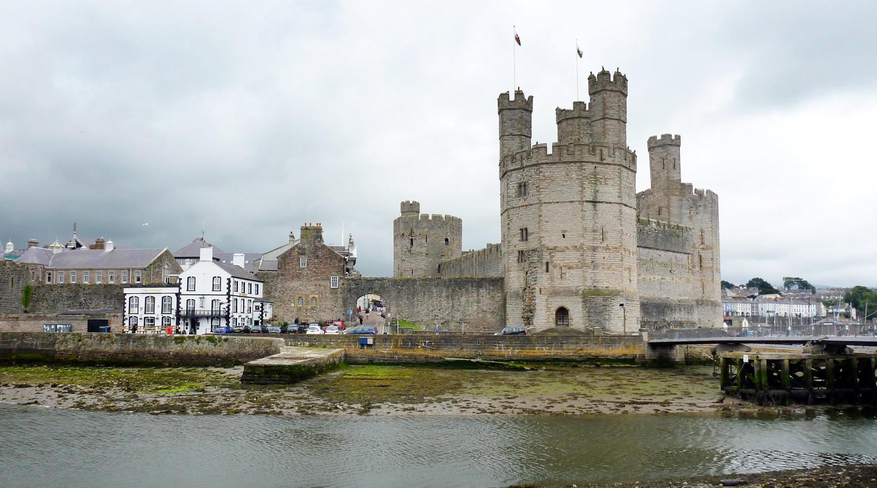
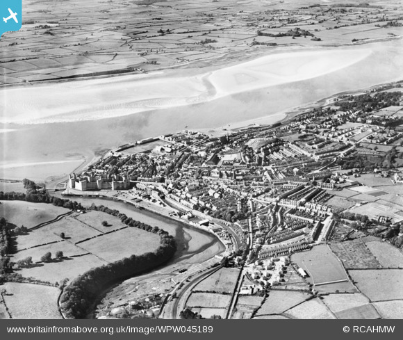
WPW045189 WALES (1934). View of Caernarfon, oblique aerial view. 5"x4" black and white glass plate negative.
© Copyright OpenStreetMap contributors and licensed by the OpenStreetMap Foundation. 2025. Cartography is licensed as CC BY-SA.
Nearby Images (30)
Details
| Title | [WPW045189] View of Caernarfon, oblique aerial view. 5"x4" black and white glass plate negative. |
| Reference | WPW045189 |
| Date | 1934 |
| Link | Coflein Archive Item 6369886 |
| Place name | |
| Parish | |
| District | |
| Country | WALES |
| Easting / Northing | 247862, 362821 |
| Longitude / Latitude | -4.2747579764211, 53.140494843476 |
| National Grid Reference | SH479628 |
Pins
 gBr |
Thursday 11th of August 2016 12:59:35 PM | |
 gBr |
Thursday 11th of August 2016 12:58:09 PM | |
 Class31 |
Tuesday 19th of March 2013 02:16:38 PM | |
 Class31 |
Tuesday 19th of March 2013 02:10:05 PM | |
 MB |
Sunday 14th of October 2012 10:52:22 AM | |
 MB |
Sunday 14th of October 2012 10:51:40 AM | |
 Class31 |
Wednesday 3rd of October 2012 08:38:45 PM | |
 Class31 |
Wednesday 3rd of October 2012 08:37:23 PM | |
 Class31 |
Wednesday 3rd of October 2012 08:36:40 PM | |
 Class31 |
Wednesday 3rd of October 2012 08:36:11 PM | |
 Class31 |
Wednesday 3rd of October 2012 08:33:48 PM | |
 Class31 |
Wednesday 3rd of October 2012 08:32:43 PM | |
 Class31 |
Wednesday 3rd of October 2012 08:32:08 PM | |
 Class31 |
Monday 9th of July 2012 12:37:31 PM | |
 Class31 |
Monday 9th of July 2012 12:36:29 PM | |
 Class31 |
Monday 9th of July 2012 12:35:43 PM | |
 Class31 |
Monday 9th of July 2012 12:33:35 PM |
User Comment Contributions
 Caernarfon Castle |
 Alan McFaden |
Thursday 4th of December 2014 10:00:57 PM |


![[WAW003594] View of Caernarfon showing castle](http://britainfromabove.org.uk/sites/all/libraries/aerofilms-images/public/100x100/WAW/003/WAW003594.jpg)
![[WAW003595] View of Caernarfon showing castle and pavilion](http://britainfromabove.org.uk/sites/all/libraries/aerofilms-images/public/100x100/WAW/003/WAW003595.jpg)
![[WAW050322] View of Shell-Mex & BP works, Victoria Dock, Caernarfon](http://britainfromabove.org.uk/sites/all/libraries/aerofilms-images/public/100x100/WAW/050/WAW050322.jpg)
![[WAW050323] View of Shell-Mex & BP works, Victoria Dock, Caernarfon](http://britainfromabove.org.uk/sites/all/libraries/aerofilms-images/public/100x100/WAW/050/WAW050323.jpg)
![[WAW050324] View of Shell-Mex & BP works, Victoria Dock, Caernarfon](http://britainfromabove.org.uk/sites/all/libraries/aerofilms-images/public/100x100/WAW/050/WAW050324.jpg)
![[WAW050325] View of Shell-Mex & BP works, Victoria Dock, Caernarfon](http://britainfromabove.org.uk/sites/all/libraries/aerofilms-images/public/100x100/WAW/050/WAW050325.jpg)
![[WAW050326] View of Shell-Mex & BP works, Victoria Dock, Caernarfon](http://britainfromabove.org.uk/sites/all/libraries/aerofilms-images/public/100x100/WAW/050/WAW050326.jpg)
![[WAW050327] View of Shell-Mex & BP works, Victoria Dock, Caernarfon](http://britainfromabove.org.uk/sites/all/libraries/aerofilms-images/public/100x100/WAW/050/WAW050327.jpg)
![[WAW050328] View of Shell-Mex & BP works, Victoria Dock, Caernarfon](http://britainfromabove.org.uk/sites/all/libraries/aerofilms-images/public/100x100/WAW/050/WAW050328.jpg)
![[WAW050329] View of Shell-Mex & BP works, Victoria Dock, Caernarfon](http://britainfromabove.org.uk/sites/all/libraries/aerofilms-images/public/100x100/WAW/050/WAW050329.jpg)
![[WAW050330] View of Caernarfon showing castle](http://britainfromabove.org.uk/sites/all/libraries/aerofilms-images/public/100x100/WAW/050/WAW050330.jpg)
![[WAW050331] View of Caernarfon showing castle](http://britainfromabove.org.uk/sites/all/libraries/aerofilms-images/public/100x100/WAW/050/WAW050331.jpg)
![[WAW050332] View of Caernarfon showing castle](http://britainfromabove.org.uk/sites/all/libraries/aerofilms-images/public/100x100/WAW/050/WAW050332.jpg)
![[WAW050333] View of Caernarfon showing castle](http://britainfromabove.org.uk/sites/all/libraries/aerofilms-images/public/100x100/WAW/050/WAW050333.jpg)
![[WAW050334] View of Caernarfon showing castle](http://britainfromabove.org.uk/sites/all/libraries/aerofilms-images/public/100x100/WAW/050/WAW050334.jpg)
![[WAW050335] View of Caernarfon showing castle](http://britainfromabove.org.uk/sites/all/libraries/aerofilms-images/public/100x100/WAW/050/WAW050335.jpg)
![[WAW050336] View of Caernarfon showing castle](http://britainfromabove.org.uk/sites/all/libraries/aerofilms-images/public/100x100/WAW/050/WAW050336.jpg)
![[WAW050337] View of Caernarfon showing castle](http://britainfromabove.org.uk/sites/all/libraries/aerofilms-images/public/100x100/WAW/050/WAW050337.jpg)
![[WAW050338] View of Caernarfon showing castle](http://britainfromabove.org.uk/sites/all/libraries/aerofilms-images/public/100x100/WAW/050/WAW050338.jpg)
![[WAW050339] View of Caernarfon showing castle](http://britainfromabove.org.uk/sites/all/libraries/aerofilms-images/public/100x100/WAW/050/WAW050339.jpg)
![[WAW050341] General view of Caernarfon showing Ysgol Maesincla school](http://britainfromabove.org.uk/sites/all/libraries/aerofilms-images/public/100x100/WAW/050/WAW050341.jpg)
![[WAW050342] General view of Caernarfon](http://britainfromabove.org.uk/sites/all/libraries/aerofilms-images/public/100x100/WAW/050/WAW050342.jpg)
![[WAW050343] General view of Caernarfon showing Ysgol Maesincla school and new housing](http://britainfromabove.org.uk/sites/all/libraries/aerofilms-images/public/100x100/WAW/050/WAW050343.jpg)
![[WAW050344] General view of Caernarfon showing new housing](http://britainfromabove.org.uk/sites/all/libraries/aerofilms-images/public/100x100/WAW/050/WAW050344.jpg)
![[WPW045186] Distant view of Caernarfon, oblique aerial view. 5"x4" black and white glass plate negative.](http://britainfromabove.org.uk/sites/all/libraries/aerofilms-images/public/100x100/WPW/045/WPW045186.jpg)
![[WPW045187] View of Caernarfon, oblique aerial view. 5"x4" black and white glass plate negative.](http://britainfromabove.org.uk/sites/all/libraries/aerofilms-images/public/100x100/WPW/045/WPW045187.jpg)
![[WPW045188] View of Caernarfon, oblique aerial view. 5"x4" black and white glass plate negative.](http://britainfromabove.org.uk/sites/all/libraries/aerofilms-images/public/100x100/WPW/045/WPW045188.jpg)
![[WPW045189] View of Caernarfon, oblique aerial view. 5"x4" black and white glass plate negative.](http://britainfromabove.org.uk/sites/all/libraries/aerofilms-images/public/100x100/WPW/045/WPW045189.jpg)
![[WPW006615] View of Caernarfon Castle, oblique aerial view. 5"x4" black and white glass plate negative.](http://britainfromabove.org.uk/sites/all/libraries/aerofilms-images/public/100x100/WPW/006/WPW006615.jpg)
![[WPW006617] View of Caernarfon showing Castle, oblique aerial view. 5"x4" black and white glass plate negative.](http://britainfromabove.org.uk/sites/all/libraries/aerofilms-images/public/100x100/WPW/006/WPW006617.jpg)