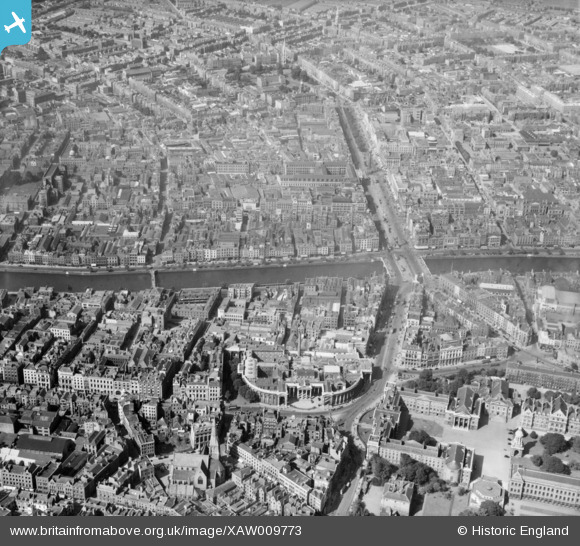
XAW009773 IRELAND (1947). Bank of Ireland and O'Connell Street , Dublin, Dublin, Ireland, 1947. Oblique aerial photograph taken facing North.
© Copyright OpenStreetMap contributors and licensed by the OpenStreetMap Foundation. 2025. Cartography is licensed as CC BY-SA.
Nearby Images (5)
Details
| Title | [XAW009773] Bank of Ireland and O'Connell Street , Dublin, Dublin, Ireland, 1947. Oblique aerial photograph taken facing North. |
| Reference | XAW009773 |
| Date | 1-September-1947 |
| Link | |
| Place name | DUBLIN |
| Parish | IRELAND |
| District | |
| Country | IRELAND |
| Easting / Northing | 116511, 391828 |
| Longitude / Latitude | -6.260906, 53.347153 |
| National Grid Reference |
Pins
 Zero |
Tuesday 11th of July 2023 01:48:04 AM | |
 Zero |
Tuesday 11th of July 2023 01:44:24 AM | |
 HeritageDublin |
Friday 17th of October 2014 10:05:28 AM | |
 HeritageDublin |
Friday 17th of October 2014 08:29:59 AM |


![[XAW009773] Bank of Ireland and O'Connell Street , Dublin, Dublin, Ireland, 1947. Oblique aerial photograph taken facing North.](http://britainfromabove.org.uk/sites/all/libraries/aerofilms-images/public/100x100/XAW/009/XAW009773.jpg)
![[XAW009777] O'Connell Street, Dublin, Dublin, Ireland, 1947. Oblique aerial photograph taken facing North.](http://britainfromabove.org.uk/sites/all/libraries/aerofilms-images/public/100x100/XAW/009/XAW009777.jpg)
![[XAW009774] Bank of Ireland and O'Connell Street , Dublin, Dublin, Ireland, 1947. Oblique aerial photograph taken facing North/West.](http://britainfromabove.org.uk/sites/all/libraries/aerofilms-images/public/100x100/XAW/009/XAW009774.jpg)
![[XPW042323] General View, Dublin, Dublin, Ireland, 1933. Oblique aerial photograph taken facing West.](http://britainfromabove.org.uk/sites/all/libraries/aerofilms-images/public/100x100/XPW/042/XPW042323.jpg)
![[XAW044977] General View, Dublin, Dublin, Ireland, 1952. Oblique aerial photograph taken facing West.](http://britainfromabove.org.uk/sites/all/libraries/aerofilms-images/public/100x100/XAW/044/XAW044977.jpg)