
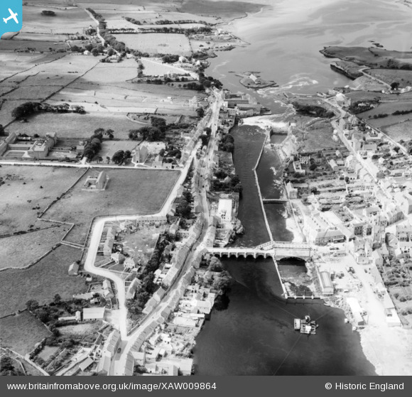
XAW009864 IRELAND (1947). Cementation Co. Works, Ballyshannon, Donegal, Ireland, 1947. Oblique aerial photograph taken facing East.
© Copyright OpenStreetMap contributors and licensed by the OpenStreetMap Foundation. 2025. Cartography is licensed as CC BY-SA.
Nearby Images (19)
XAW009864

XAW019078

XAW027527

XAW019074

XAW027599

XAW009868

XAW019037

XAW009866

XAW019038

XAW019076

XAW027553

XAW019032

XAW019080

XAW027552

XAW019083

XAW019067

XAW019073

XAW019039

XAW019090

Details
| Title | [XAW009864] Cementation Co. Works, Ballyshannon, Donegal, Ireland, 1947. Oblique aerial photograph taken facing East. |
| Reference | XAW009864 |
| Date | 3-September-1947 |
| Link | |
| Place name | BALLYSHANNON |
| Parish | IRELAND |
| District | |
| Country | IRELAND |
| Easting / Northing | -433, 529414 |
| Longitude / Latitude | -8.188627, 54.501294 |
| National Grid Reference |
Pins
Be the first to add a comment to this image!