
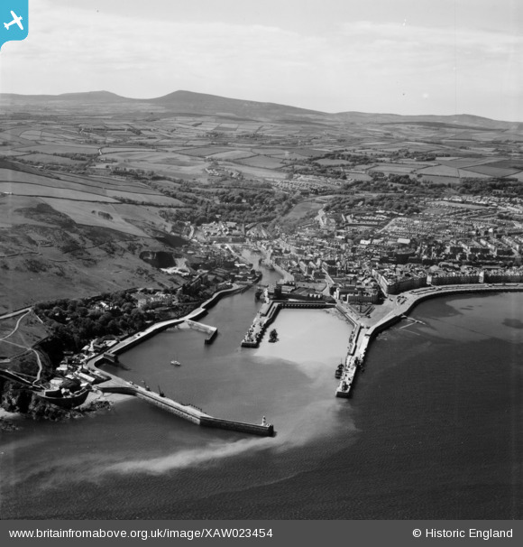
XAW023454 ISLE OF MAN (1949). Douglas Harbour, Douglas, Isle of Man, Isle of Man, 1949. Oblique aerial photograph taken facing West.
© Copyright OpenStreetMap contributors and licensed by the OpenStreetMap Foundation. 2025. Cartography is licensed as CC BY-SA.
Nearby Images (2)
XAW023454

XAW044809

Details
| Title | [XAW023454] Douglas Harbour, Douglas, Isle of Man, Isle of Man, 1949. Oblique aerial photograph taken facing West. |
| Reference | XAW023454 |
| Date | 26-May-1949 |
| Link | |
| Place name | DOUGLAS |
| Parish | ISLE OF MAN |
| District | |
| Country | ISLE OF MAN |
| Easting / Northing | 238759, 475097 |
| Longitude / Latitude | -4.470153, 54.146324 |
| National Grid Reference |
Pins
Be the first to add a comment to this image!