
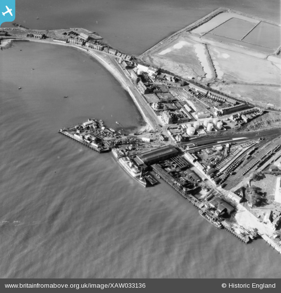
XAW033136 NORTHERN IRELAND (1950). General View, Larne, Larne, Northern Ireland, 1950. Oblique aerial photograph taken facing South/West.
© Copyright OpenStreetMap contributors and licensed by the OpenStreetMap Foundation. 2025. Cartography is licensed as CC BY-SA.
Nearby Images (8)
XAW033136

XAW040443

XAW040444

XAW040441

XAW040442

XAW040449

XAW033137

XAW040450

Details
| Title | [XAW033136] General View, Larne, Larne, Northern Ireland, 1950. Oblique aerial photograph taken facing South/West. |
| Reference | XAW033136 |
| Date | 15-September-1950 |
| Link | |
| Place name | LARNE |
| Parish | NORTHERN IRELAND |
| District | |
| Country | NORTHERN IRELAND |
| Easting / Northing | 156210, 556899 |
| Longitude / Latitude | -5.799025, 54.847366 |
| National Grid Reference |
Pins
 Michael |
Wednesday 15th of September 2021 10:37:22 AM |