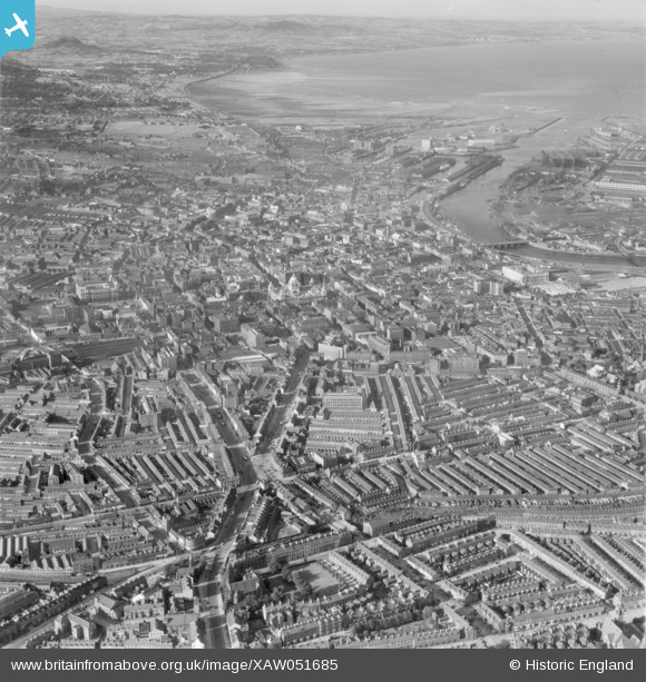
XAW051685 NORTHERN IRELAND (1953). Belfast Spec, Belfast, Belfast, Northern Ireland, 1953. Oblique aerial photograph taken facing North.
© Copyright OpenStreetMap contributors and licensed by the OpenStreetMap Foundation. 2025. Cartography is licensed as CC BY-SA.
Details
| Title | [XAW051685] Belfast Spec, Belfast, Belfast, Northern Ireland, 1953. Oblique aerial photograph taken facing North. |
| Reference | XAW051685 |
| Date | 26-August-1953 |
| Link | |
| Place name | BELFAST |
| Parish | NORTHERN IRELAND |
| District | |
| Country | NORTHERN IRELAND |
| Easting / Northing | 145965, 528734 |
| Longitude / Latitude | -5.933641, 54.589768 |
| National Grid Reference |
Pins
 Jk |
Tuesday 20th of February 2024 02:36:28 PM | |
 Michael |
Tuesday 14th of September 2021 07:12:40 PM | |
 Michael |
Tuesday 14th of September 2021 07:11:37 PM | |
 Michael |
Tuesday 14th of September 2021 07:10:47 PM | |
 Michael |
Tuesday 14th of September 2021 07:10:31 PM | |
 Michael |
Tuesday 14th of September 2021 07:09:04 PM | |
 Michael |
Tuesday 14th of September 2021 07:08:10 PM | |
 Michael |
Tuesday 14th of September 2021 07:07:27 PM | |
 Michael |
Tuesday 14th of September 2021 07:06:38 PM | |
 Stephen Craig |
Monday 6th of July 2015 05:30:43 PM | |
 gBr |
Sunday 11th of January 2015 07:20:03 AM | |
 gBr |
Sunday 11th of January 2015 07:18:13 AM |
User Comment Contributions
 Stephen Craig |
Monday 6th of July 2015 05:31:31 PM |


![[XAW051685] Belfast Spec, Belfast, Belfast, Northern Ireland, 1953. Oblique aerial photograph taken facing North.](http://britainfromabove.org.uk/sites/all/libraries/aerofilms-images/public/100x100/XAW/051/XAW051685.jpg)
![[XPW008394] Ulster Engineering Co, Belfast, Belfast, Northern Ireland, 1923. Oblique aerial photograph taken facing East.](http://britainfromabove.org.uk/sites/all/libraries/aerofilms-images/public/100x100/XPW/008/XPW008394.jpg)
