
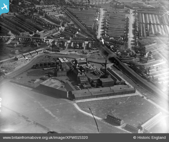
XPW015320 NORTHERN IRELAND (1926). Distellery, Belfast, Belfast, Northern Ireland, 1926. Oblique aerial photograph taken facing South.
© Copyright OpenStreetMap contributors and licensed by the OpenStreetMap Foundation. 2025. Cartography is licensed as CC BY-SA.
Nearby Images (11)
XPW015320

XAW027622

XAW027621

XAW027619

XAW027623

XPW008411

XAW027620

XAW027616

XAW027615

XAW027624

XAW027618

Details
| Title | [XPW015320] Distellery, Belfast, Belfast, Northern Ireland, 1926. Oblique aerial photograph taken facing South. |
| Reference | XPW015320 |
| Date | 1926 |
| Link | |
| Place name | BELFAST |
| Parish | NORTHERN IRELAND |
| District | |
| Country | NORTHERN IRELAND |
| Easting / Northing | 148929, 529514 |
| Longitude / Latitude | -5.888548, 54.598242 |
| National Grid Reference |
Pins
 Buzby |
Sunday 14th of December 2014 12:00:50 PM | |
Patrick Davey |
Saturday 18th of October 2014 11:31:15 AM |