
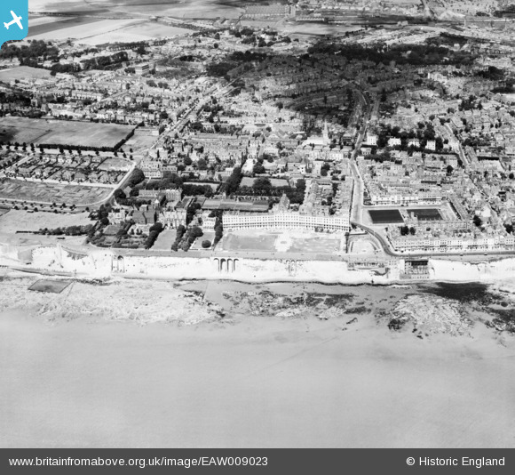
EAW009023 ENGLAND (1947). West Cliff, Royal Crescent and the surrounding area, Ramsgate, 1947
© Copyright OpenStreetMap contributors and licensed by the OpenStreetMap Foundation. 2024. Cartography is licensed as CC BY-SA.
Nearby Images (12)
EAW009023

EPW000094

EPW000090

EPW000081

EPW000097

EPW052895

EPW013301

EPW000601

EPW035451

EAW009024

EAW009025

EPW039356

Details
| Title | [EAW009023] West Cliff, Royal Crescent and the surrounding area, Ramsgate, 1947 |
| Reference | EAW009023 |
| Date | 12-August-1947 |
| Link | |
| Place name | RAMSGATE |
| Parish | RAMSGATE |
| District | |
| Country | ENGLAND |
| Easting / Northing | 637790, 164385 |
| Longitude / Latitude | 1.4136970827943, 51.328258294049 |
| National Grid Reference | TR378644 |
Pins
 CatherineE |
Wednesday 14th of September 2022 06:28:47 PM | |
Dodger |
Monday 22nd of September 2014 01:21:57 PM |