
Scheduled Maintenance
This website will undergo scheduled maintenance on Tuesday, September 10th, between 11:00 and 15:00, as well as on Thursday, September 12th, between 10:00 and 12:00. During this time, services may be temporarily disrupted. We apologise for any inconvenience.
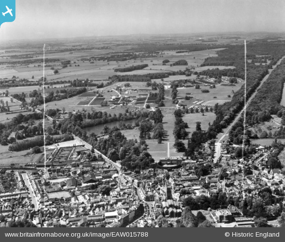
EAW015788 ENGLAND (1948). The 188th US Army General Hospital in Cirencester Park, Cirencester, from the east, 1948. This image has been produced from a print marked by Aerofilms Ltd for photo editing.
© Copyright OpenStreetMap contributors and licensed by the OpenStreetMap Foundation. 2024. Cartography is licensed as CC BY-SA.
Nearby Images (15)
EAW015788

EAW015789

EAW031680

EAW015790

EPW022407

EAW031677

EAW031679

EPW022412

EPW006310

EPW022416

EPW037748

EPW022410

EAW031681

EPW061776

EPW061775

Details
| Title | [EAW015788] The 188th US Army General Hospital in Cirencester Park, Cirencester, from the east, 1948. This image has been produced from a print marked by Aerofilms Ltd for photo editing. |
| Reference | EAW015788 |
| Date | 18-May-1948 |
| Link | |
| Place name | CIRENCESTER |
| Parish | CIRENCESTER |
| District | |
| Country | ENGLAND |
| Easting / Northing | 402077, 201984 |
| Longitude / Latitude | -1.96993223605, 51.716122461979 |
| National Grid Reference | SP021020 |
