
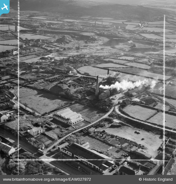
EAW027872 ENGLAND (1950). South Crofty Tin Mine and environs, Pool, 1950. This image was marked by Aerofilms Ltd for photo editing.
© Copyright OpenStreetMap contributors and licensed by the OpenStreetMap Foundation. 2024. Cartography is licensed as CC BY-SA.
Nearby Images (12)
EAW027872

EAW027874

EAW027875

EAW027871

EAW027873

EAW027876

EAW027870

EAW027869

EAW027879

EAW027880

EAW027877

EAW027878

Details
| Title | [EAW027872] South Crofty Tin Mine and environs, Pool, 1950. This image was marked by Aerofilms Ltd for photo editing. |
| Reference | EAW027872 |
| Date | 17-January-1950 |
| Link | |
| Place name | POOL |
| Parish | CARN BREA |
| District | |
| Country | ENGLAND |
| Easting / Northing | 166787, 41290 |
| Longitude / Latitude | -5.2700292570371, 50.224931139236 |
| National Grid Reference | SW668413 |
Pins
Be the first to add a comment to this image!