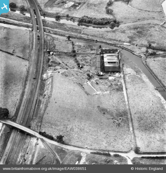
EAW038651 ENGLAND (1951). Baswich Salt Works, Baswich, 1951. This image has been produced from a print.

© Copyright OpenStreetMap contributors and licensed by the OpenStreetMap Foundation. 2024. Cartography is licensed as CC BY-SA.

Nearby Images (10)

EAW038651
  0° 0m
EAW038650
  336° 15m
EAW038649
  357° 22m
EAW038653
  294° 36m
EAW038643
  299° 50m
EAW038648
  302° 59m
EAW038647
  281° 67m
EAW038646
  302° 80m
EAW038654
  315° 80m
EAW038652
  295° 84m

Details

Title [EAW038651] Baswich Salt Works, Baswich, 1951. This image has been produced from a print.
Reference EAW038651
Date 14-August-1951
Link
Place name BASWICH
Parish
District
Country ENGLAND
Easting / Northing 394479, 322607
Longitude / Latitude -2.0818986901501, 52.800661204073
National Grid Reference SJ945226

Pins

PILLBOX (TYPE FW3/26): S0007797

Matt Aldred edob.mattaldred.com
Tuesday 8th of September 2020 02:34:07 PM
Baswich Lane: approaching St Thomas' Bridge (Bridge 101) over the Staffordshire & Worcestershire Canal. (DJJ).

David
Sunday 21st of December 2014 08:53:07 PM
Baswich Lane Road Bridge over the Railway. (DJJ).

David
Sunday 21st of December 2014 08:50:57 PM
The Railway Bridge (Bridge 100A) over the Staffordshire & Worcestershire Canal. (DJJ).

David
Sunday 21st of December 2014 08:49:10 PM
Stafford Branch Canal / River Sow Navigation. Footbridge over the River Penk. The footbridge still exists(December 2014)but no longer goes over any water following the realignment of the Rivers Penk and Sow some years ago. (Stafford Riverway Link: www.stafford-riverway-link.co.uk )(DJJ)

David
Sunday 21st of December 2014 04:51:28 PM
The River Penk, close to its confluence with the River Sow. (DJJ).

David
Sunday 21st of December 2014 02:47:02 PM
Junction of Stafford Branch Canal / River Sow Navigation with the Staffs and Worcs Canal. The Outside Toilet of the Lock House. (Stafford Riverway Link: www.stafford-riverway-link.co.uk )(DJJ)

David
Sunday 21st of December 2014 01:06:30 PM
The Canal Arm in the Salt Works. (DJJ)

David
Sunday 21st of December 2014 01:04:29 PM
Junction of Stafford Branch Canal / River Sow Navigation with the Staffs and Worcs Canal. The former Branch Canal Basin (with Tow Path, hawthorn hedge and the Lock House). (Stafford Riverway Link: www.stafford-riverway-link.co.uk )(DJJ)

David
Sunday 21st of December 2014 01:02:24 PM
Junction of Stafford Branch Canal / River Sow Navigation with the Staffs and Worcs Canal. The Roving Bridge at the Junction. (Stafford Riverway Link: www.stafford-riverway-link.co.uk )(DJJ)

David
Sunday 21st of December 2014 12:57:51 PM
Junction of Stafford Branch Canal / River Sow Navigation with the Staffs and Worcs Canal. The Pigsty, between the Roving Bridge and the Lock House. (Stafford Riverway Link: www.stafford-riverway-link.co.uk )(DJJ)

David
Sunday 21st of December 2014 12:56:45 PM
Junction of Stafford Branch Canal / River Sow Navigation with the Staffs and Worcs Canal. The Lock House. (Stafford Riverway Link: www.stafford-riverway-link.co.uk )(DJJ)

David
Sunday 21st of December 2014 12:55:25 PM
Junction of Stafford Branch Canal / River Sow Navigation with the Staffs and Worcs Canal. Notice the Roving Bridge at the Junction and the Lock House. (Stafford Riverway Link: www.stafford-riverway-link.co.uk )(DJJ)

David
Sunday 21st of December 2014 12:54:39 PM