
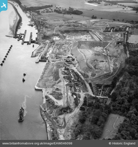
EAW046098 ENGLAND (1952). Construction of the Queen Elizabeth II Dock, Eastham, 1952
© Copyright OpenStreetMap contributors and licensed by the OpenStreetMap Foundation. 2024. Cartography is licensed as CC BY-SA.
Nearby Images (4)
EAW046098

EAW046097

EAW046096

EAW046104

Details
| Title | [EAW046098] Construction of the Queen Elizabeth II Dock, Eastham, 1952 |
| Reference | EAW046098 |
| Date | 25-August-1952 |
| Link | |
| Place name | EASTHAM |
| Parish | |
| District | |
| Country | ENGLAND |
| Easting / Northing | 336624, 381366 |
| Longitude / Latitude | -2.9516226473511, 53.325145035429 |
| National Grid Reference | SJ366814 |
Pins
Be the first to add a comment to this image!