
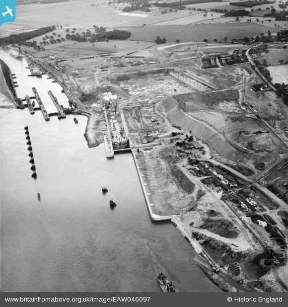
EAW046097 ENGLAND (1952). Construction of the Queen Elizabeth II Dock, Eastham, 1952
© Copyright OpenStreetMap contributors and licensed by the OpenStreetMap Foundation. 2024. Cartography is licensed as CC BY-SA.
Nearby Images (6)
EAW046097

EAW046096

EAW046098

EAW046104

EAW046101

EAW015935

Details
| Title | [EAW046097] Construction of the Queen Elizabeth II Dock, Eastham, 1952 |
| Reference | EAW046097 |
| Date | 25-August-1952 |
| Link | |
| Place name | EASTHAM |
| Parish | |
| District | |
| Country | ENGLAND |
| Easting / Northing | 336708, 381303 |
| Longitude / Latitude | -2.9503489515165, 53.324588812727 |
| National Grid Reference | SJ367813 |
Pins
 Bottom Yard |
Monday 31st of December 2018 03:46:37 PM |