
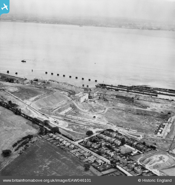
EAW046101 ENGLAND (1952). Construction of the Queen Elizabeth II Dock, Eastham, 1952
© Copyright OpenStreetMap contributors and licensed by the OpenStreetMap Foundation. 2024. Cartography is licensed as CC BY-SA.
Nearby Images (8)
EAW046101

EAW015935

EAW046102

EAW015936

EAW046104

EAW046096

EAW046097

EPW027870

Details
| Title | [EAW046101] Construction of the Queen Elizabeth II Dock, Eastham, 1952 |
| Reference | EAW046101 |
| Date | 25-August-1952 |
| Link | |
| Place name | EASTHAM |
| Parish | |
| District | |
| Country | ENGLAND |
| Easting / Northing | 336878, 381114 |
| Longitude / Latitude | -2.9477590850153, 53.322910289116 |
| National Grid Reference | SJ369811 |
Pins
 sloyne |
Wednesday 6th of October 2021 01:02:45 AM | |
Bottom Yard |
Monday 31st of December 2018 07:56:03 PM | |
Bottom Yard |
Monday 31st of December 2018 06:56:31 PM | |
Bottom Yard |
Monday 31st of December 2018 06:46:28 PM |