
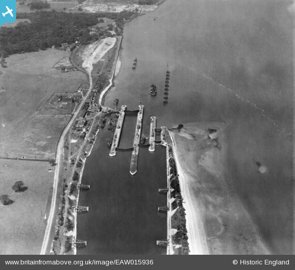
EAW015936 ENGLAND (1948). Eastham Locks, Eastham, 1948. This image has been produced from a print.
© Copyright OpenStreetMap contributors and licensed by the OpenStreetMap Foundation. 2024. Cartography is licensed as CC BY-SA.
Nearby Images (8)
EAW015936

EAW015935

EAW046101

EPW027870

EPW027829

EAW046102

EAW046103

EAW046099

Details
| Title | [EAW015936] Eastham Locks, Eastham, 1948. This image has been produced from a print. |
| Reference | EAW015936 |
| Date | 20-May-1948 |
| Link | |
| Place name | EASTHAM |
| Parish | |
| District | |
| Country | ENGLAND |
| Easting / Northing | 337004, 381023 |
| Longitude / Latitude | -2.945849424343, 53.322107346706 |
| National Grid Reference | SJ370810 |
Pins
 Matt Aldred edob.mattaldred.com |
Sunday 29th of November 2020 09:43:12 PM | |
Matt Aldred edob.mattaldred.com |
Sunday 29th of November 2020 09:43:02 PM | |
Matt Aldred edob.mattaldred.com |
Sunday 29th of November 2020 09:42:16 PM | |
 redmist |
Sunday 6th of October 2019 11:21:15 PM | |
redmist |
Sunday 6th of October 2019 11:19:47 PM | |
Bottom Yard |
Monday 31st of December 2018 09:19:29 PM |