
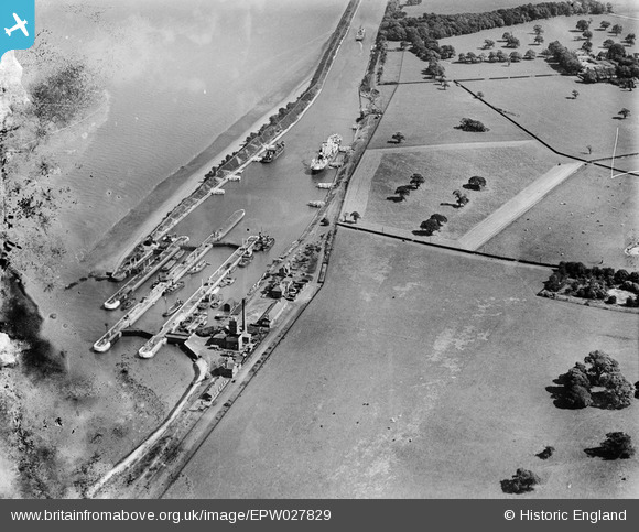
EPW027829 ENGLAND (1929). Eastham Locks and the Manchester Ship Canal, Eastham, 1929. This image has been produced from a damaged negative.
© Copyright OpenStreetMap contributors and licensed by the OpenStreetMap Foundation. 2024. Cartography is licensed as CC BY-SA.
Nearby Images (7)
EPW027829

EPW027870

EAW015936

EAW046103

EAW046099

EAW046102

EAW015935

Details
| Title | [EPW027829] Eastham Locks and the Manchester Ship Canal, Eastham, 1929. This image has been produced from a damaged negative. |
| Reference | EPW027829 |
| Date | June-1929 |
| Link | |
| Place name | EASTHAM |
| Parish | |
| District | |
| Country | ENGLAND |
| Easting / Northing | 336960, 380864 |
| Longitude / Latitude | -2.946478334903, 53.320672936123 |
| National Grid Reference | SJ370809 |
Pins
 Bottom Yard |
Monday 31st of December 2018 03:18:43 PM | |
Bottom Yard |
Monday 31st of December 2018 03:16:12 PM | |
Pete65 |
Monday 14th of October 2013 11:15:08 AM |