
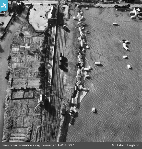
EAW048297 ENGLAND (1953). Flooded caravan camp near Beach Station, Felixstowe, 1953
© Copyright OpenStreetMap contributors and licensed by the OpenStreetMap Foundation. 2024. Cartography is licensed as CC BY-SA.
Nearby Images (4)
EAW048297

EAW048291

EAW048290

EAW024307

Details
| Title | [EAW048297] Flooded caravan camp near Beach Station, Felixstowe, 1953 |
| Reference | EAW048297 |
| Date | 2-March-1953 |
| Link | |
| Place name | FELIXSTOWE |
| Parish | FELIXSTOWE |
| District | |
| Country | ENGLAND |
| Easting / Northing | 629229, 233663 |
| Longitude / Latitude | 1.3364029904024, 51.953698384675 |
| National Grid Reference | TM292337 |
Pins
Be the first to add a comment to this image!