
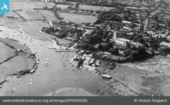
EPR000281 ENGLAND (1934). The River Stour, Christchurch Priory and the town, Christchurch, 1934
© Copyright OpenStreetMap contributors and licensed by the OpenStreetMap Foundation. 2024. Cartography is licensed as CC BY-SA.
Nearby Images (18)
EPR000281

EAW034633

EPR000280

EAW049063

EPW013616

EPW018172

EPW018171

EPW037439

EPW013614

EAW049062

EAW034632

EAW034630

EAW034634

EAW034629

EPW013615

EPW037405

EAW034631

EPW037406

Details
| Title | [EPR000281] The River Stour, Christchurch Priory and the town, Christchurch, 1934 |
| Reference | EPR000281 |
| Date | 26-August-1934 |
| Link | |
| Place name | CHRISTCHURCH |
| Parish | |
| District | |
| Country | ENGLAND |
| Easting / Northing | 416011, 92430 |
| Longitude / Latitude | -1.7731131672065, 50.730693823029 |
| National Grid Reference | SZ160924 |
