
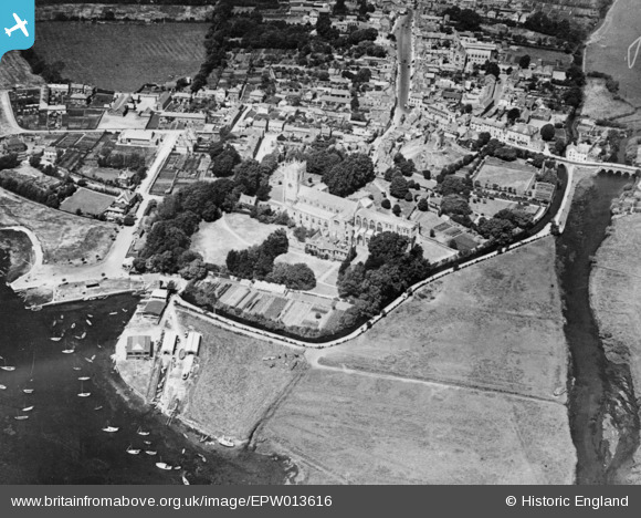
EPW013616 ENGLAND (1925). Christ Church and environs, Christchurch, 1925. This image has been produced from a copy-negative.
© Copyright OpenStreetMap contributors and licensed by the OpenStreetMap Foundation. 2024. Cartography is licensed as CC BY-SA.
Nearby Images (18)
EPW013616

EPW037439

EPW018171

EAW049063

EAW034633

EPR000281

EAW034632

EAW034630

EPW013614

EPR000280

EPW018172

EAW034634

EPW013615

EAW049062

EAW034629

EPW037405

EAW034631

EPW037406

Details
| Title | [EPW013616] Christ Church and environs, Christchurch, 1925. This image has been produced from a copy-negative. |
| Reference | EPW013616 |
| Date | June-1925 |
| Link | |
| Place name | CHRISTCHURCH |
| Parish | |
| District | |
| Country | ENGLAND |
| Easting / Northing | 416038, 92494 |
| Longitude / Latitude | -1.7727277768554, 50.731268669727 |
| National Grid Reference | SZ160925 |
Pins
 MikeMist |
Saturday 7th of November 2020 02:52:09 PM |