
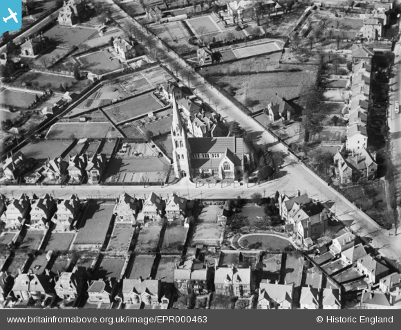
EPR000463 ENGLAND (1935). St Matthew's Church, Surbiton, 1935
© Copyright OpenStreetMap contributors and licensed by the OpenStreetMap Foundation. 2024. Cartography is licensed as CC BY-SA.
Nearby Images (3)
EPR000463

EPW008675

EPW008689

Details
| Title | [EPR000463] St Matthew's Church, Surbiton, 1935 |
| Reference | EPR000463 |
| Date | 21-March-1935 |
| Link | |
| Place name | SURBITON |
| Parish | |
| District | |
| Country | ENGLAND |
| Easting / Northing | 518576, 166523 |
| Longitude / Latitude | -0.29579730095521, 51.38485356627 |
| National Grid Reference | TQ186665 |
Pins
Be the first to add a comment to this image!