
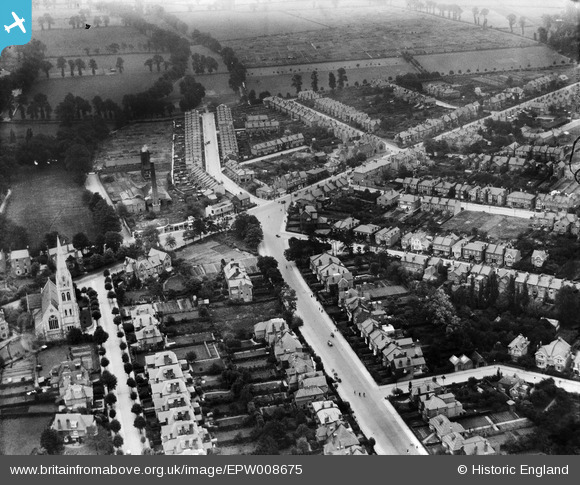
EPW008675 ENGLAND (1923). The junction of Kingsdowne Road and Ditton Road, Southborough, 1923
© Copyright OpenStreetMap contributors and licensed by the OpenStreetMap Foundation. 2024. Cartography is licensed as CC BY-SA.
Nearby Images (3)
EPW008675

EPW008689

EPR000463

Details
| Title | [EPW008675] The junction of Kingsdowne Road and Ditton Road, Southborough, 1923 |
| Reference | EPW008675 |
| Date | 1923 |
| Link | |
| Place name | SOUTHBOROUGH |
| Parish | |
| District | |
| Country | ENGLAND |
| Easting / Northing | 518732, 166459 |
| Longitude / Latitude | -0.29357770025447, 51.384245670051 |
| National Grid Reference | TQ187665 |
Pins
 LynC |
Friday 17th of October 2014 09:46:58 AM | |
Pip |
Thursday 2nd of January 2014 05:08:07 PM | |
Pip |
Thursday 2nd of January 2014 04:41:42 PM | |
Pip |
Thursday 2nd of January 2014 04:40:25 PM | |
Pip |
Thursday 2nd of January 2014 04:40:03 PM | |
Pip |
Thursday 2nd of January 2014 04:38:51 PM | |
Pip |
Wednesday 1st of January 2014 12:52:27 PM | |
Pip |
Wednesday 1st of January 2014 12:50:47 PM | |
Pip |
Wednesday 1st of January 2014 12:50:03 PM | |
Pip |
Wednesday 1st of January 2014 12:49:36 PM | |
Pip |
Wednesday 1st of January 2014 12:49:10 PM | |
David Wraith |
Friday 23rd of August 2013 02:03:34 PM | |
 Dylan Moore |
Saturday 4th of May 2013 03:42:57 PM | |
Dylan Moore |
Saturday 4th of May 2013 03:42:21 PM | |
Dylan Moore |
Saturday 4th of May 2013 03:41:54 PM | |
Dylan Moore |
Saturday 4th of May 2013 03:41:31 PM | |
Dylan Moore |
Saturday 4th of May 2013 03:40:40 PM |
User Comment Contributions
Thanks for pinning the road names to confirm the location, Dylan. We'll update the catalogue, and post the data here in due course. Yours, Katy Britain from Above Cataloguing Team Leader |
Katy Whitaker |
Monday 1st of July 2013 12:57:22 PM |