
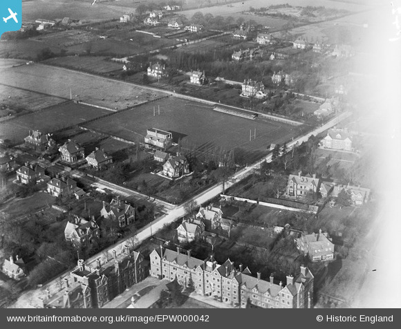
EPW000042 ENGLAND (1920). The University Rugby Ground, Cambridge, 1920
© Copyright OpenStreetMap contributors and licensed by the OpenStreetMap Foundation. 2024. Cartography is licensed as CC BY-SA.
Nearby Images (6)
EPW000042

EPW045038

EPW045039

EPW045036

EPW000044

EPW000051

Details
| Title | [EPW000042] The University Rugby Ground, Cambridge, 1920 |
| Reference | EPW000042 |
| Date | January-1920 |
| Link | |
| Place name | CAMBRIDGE |
| Parish | |
| District | |
| Country | ENGLAND |
| Easting / Northing | 543934, 258137 |
| Longitude / Latitude | 0.10644286098518, 52.202240389936 |
| National Grid Reference | TL439581 |
Pins
 BoldForester |
Wednesday 10th of October 2012 10:37:25 PM | |
BoldForester |
Thursday 19th of July 2012 09:06:41 PM |
User Comment Contributions
This image also shows Selwyn College, Cambridge. It is the collection of buildings in the centre foreground. |
jly |
Tuesday 26th of June 2012 08:06:13 PM |