
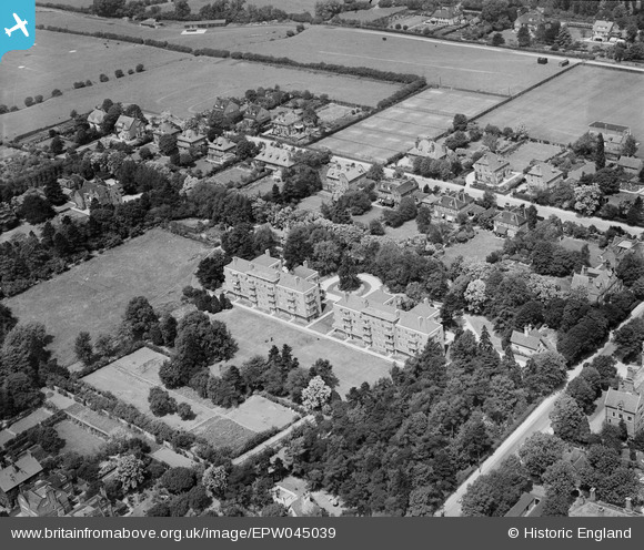
EPW045039 ENGLAND (1934). Manor Court and Grange Court flats, Cambridge, 1934
© Copyright OpenStreetMap contributors and licensed by the OpenStreetMap Foundation. 2024. Cartography is licensed as CC BY-SA.
Nearby Images (5)
EPW045039

EPW045038

EPW000042

EPW000044

EPW000054

Details
| Title | [EPW045039] Manor Court and Grange Court flats, Cambridge, 1934 |
| Reference | EPW045039 |
| Date | June-1934 |
| Link | |
| Place name | CAMBRIDGE |
| Parish | |
| District | |
| Country | ENGLAND |
| Easting / Northing | 543838, 257980 |
| Longitude / Latitude | 0.10497226732764, 52.200854750254 |
| National Grid Reference | TL438580 |
Pins
Be the first to add a comment to this image!