
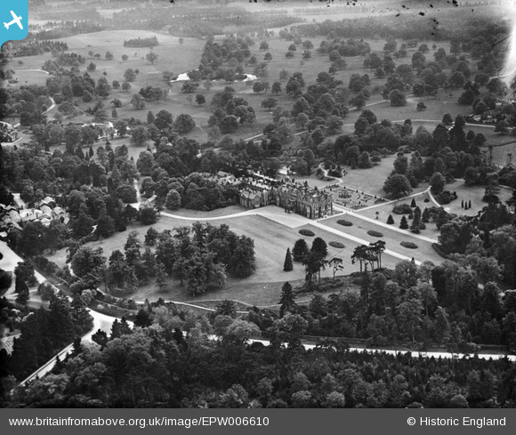
EPW006610 ENGLAND (1921). Sandringham House and Park, Sandringham, 1921
© Copyright OpenStreetMap contributors and licensed by the OpenStreetMap Foundation. 2024. Cartography is licensed as CC BY-SA.
Nearby Images (8)
EPW006610

EPW039200

EPW006613

EPW006611

EPW021553

EPW039199

EPW021554

EPW039201

Details
| Title | [EPW006610] Sandringham House and Park, Sandringham, 1921 |
| Reference | EPW006610 |
| Date | June-1921 |
| Link | |
| Place name | SANDRINGHAM |
| Parish | SANDRINGHAM |
| District | |
| Country | ENGLAND |
| Easting / Northing | 569459, 328778 |
| Longitude / Latitude | 0.51564260298304, 52.829511205545 |
| National Grid Reference | TF695288 |
Pins
Be the first to add a comment to this image!