
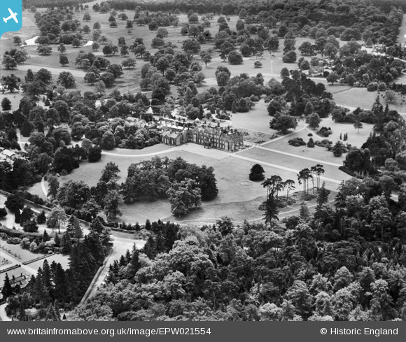
EPW021554 ENGLAND (1928). Sandringham House, Sandringham, 1928
© Copyright OpenStreetMap contributors and licensed by the OpenStreetMap Foundation. 2024. Cartography is licensed as CC BY-SA.
Nearby Images (8)
EPW021554

EPW039200

EPW006610

EPW006613

EPW006611

EPW021553

EPW039199

EPW039201

Details
| Title | [EPW021554] Sandringham House, Sandringham, 1928 |
| Reference | EPW021554 |
| Date | June-1928 |
| Link | |
| Place name | SANDRINGHAM |
| Parish | SANDRINGHAM |
| District | |
| Country | ENGLAND |
| Easting / Northing | 569514, 328833 |
| Longitude / Latitude | 0.51648679086515, 52.82998790728 |
| National Grid Reference | TF695288 |
Pins
Be the first to add a comment to this image!