
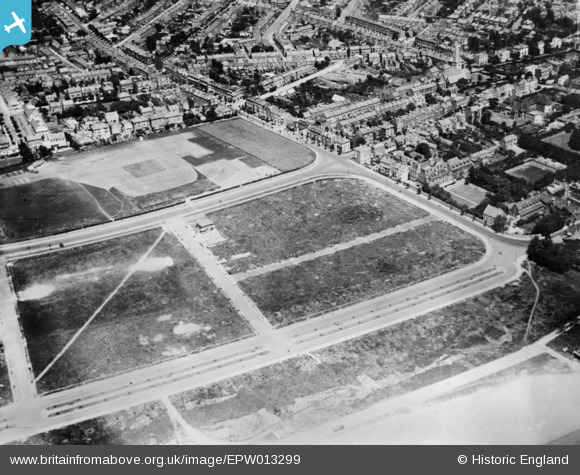
EPW013299 ENGLAND (1925). Grange Road and environs, Ramsgate, 1925. This image has been produced from a copy-negative.
© Copyright OpenStreetMap contributors and licensed by the OpenStreetMap Foundation. 2024. Cartography is licensed as CC BY-SA.
Nearby Images (6)
EPW013299

EAW009021

EPW013300

EAW009020

EAW009025

EPW052895

Details
| Title | [EPW013299] Grange Road and environs, Ramsgate, 1925. This image has been produced from a copy-negative. |
| Reference | EPW013299 |
| Date | June-1925 |
| Link | |
| Place name | RAMSGATE |
| Parish | RAMSGATE |
| District | |
| Country | ENGLAND |
| Easting / Northing | 637432, 164408 |
| Longitude / Latitude | 1.4085827545886, 51.328614317161 |
| National Grid Reference | TR374644 |
Pins
Be the first to add a comment to this image!