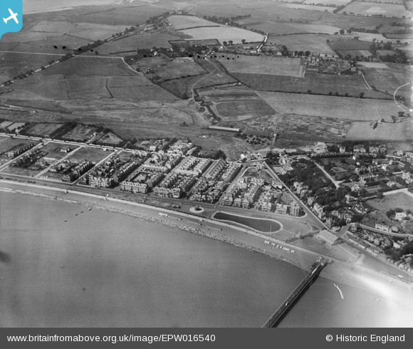
EPW016540 ENGLAND (1926). The Model Yacht Pond and Sea Road area, Felixstowe, 1926
© Copyright OpenStreetMap contributors and licensed by the OpenStreetMap Foundation. 2024. Cartography is licensed as CC BY-SA.
Nearby Images (6)
EPW016540

EPW001922

EPW001920

EPW001918

EAW024305

EPW039284

Details
| Title | [EPW016540] The Model Yacht Pond and Sea Road area, Felixstowe, 1926 |
| Reference | EPW016540 |
| Date | August-1926 |
| Link | |
| Place name | FELIXSTOWE |
| Parish | FELIXSTOWE |
| District | |
| Country | ENGLAND |
| Easting / Northing | 629618, 234025 |
| Longitude / Latitude | 1.3422963242685, 51.956787430649 |
| National Grid Reference | TM296340 |
Pins
 Ashbarrett |
Tuesday 26th of June 2012 11:49:38 AM |