
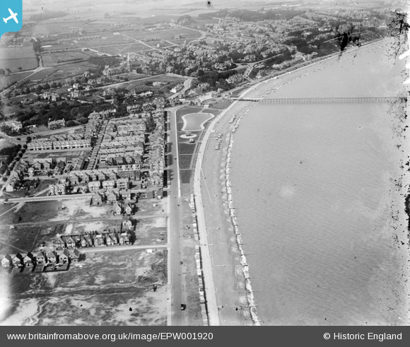
EPW001920 ENGLAND (1920). View of Felixstowe and the New Pier, Felixstowe, 1920
© Copyright OpenStreetMap contributors and licensed by the OpenStreetMap Foundation. 2024. Cartography is licensed as CC BY-SA.
Nearby Images (6)
EPW001920

EPW039284

EPW016540

EPW001918

EPW001921

EAW024308

Details
| Title | [EPW001920] View of Felixstowe and the New Pier, Felixstowe, 1920 |
| Reference | EPW001920 |
| Date | June-1920 |
| Link | |
| Place name | FELIXSTOWE |
| Parish | FELIXSTOWE |
| District | |
| Country | ENGLAND |
| Easting / Northing | 629796, 233896 |
| Longitude / Latitude | 1.3447962387517, 51.955555948473 |
| National Grid Reference | TM298339 |
Pins
Be the first to add a comment to this image!
User Comment Contributions
Look how clean and fresh the place looks. |
 trigger |
Wednesday 27th of June 2012 05:51:47 PM |