
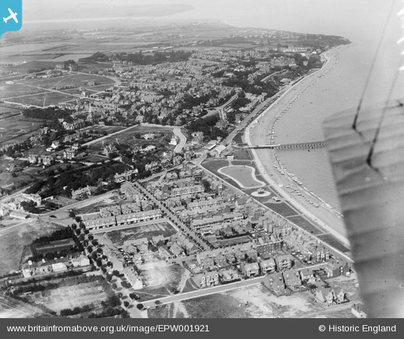
EPW001921 ENGLAND (1920). View of Felixstowe and the New Pier, Felixstowe, 1920
© Copyright OpenStreetMap contributors and licensed by the OpenStreetMap Foundation. 2024. Cartography is licensed as CC BY-SA.
Nearby Images (8)
EPW001921

EPW001918

EAW024305

EPW039279

EAW024310

EAW024306

EPW001920

EPW049328

Details
| Title | [EPW001921] View of Felixstowe and the New Pier, Felixstowe, 1920 |
| Reference | EPW001921 |
| Date | June-1920 |
| Link | |
| Place name | FELIXSTOWE |
| Parish | FELIXSTOWE |
| District | |
| Country | ENGLAND |
| Easting / Northing | 629887, 234130 |
| Longitude / Latitude | 1.3462748984923, 51.957618835676 |
| National Grid Reference | TM299341 |
Pins
 Choco |
Sunday 8th of July 2012 08:29:51 PM |