
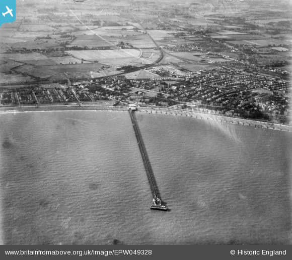
EPW049328 ENGLAND (1935). The Pier and the town, Felixstowe, 1935. This image has been produced from a copy-negative.
© Copyright OpenStreetMap contributors and licensed by the OpenStreetMap Foundation. 2024. Cartography is licensed as CC BY-SA.
Nearby Images (4)
EPW049328

EAW024310

EPW039279

EPW001921

Details
| Title | [EPW049328] The Pier and the town, Felixstowe, 1935. This image has been produced from a copy-negative. |
| Reference | EPW049328 |
| Date | September-1935 |
| Link | |
| Place name | FELIXSTOWE |
| Parish | FELIXSTOWE |
| District | |
| Country | ENGLAND |
| Easting / Northing | 630133, 234062 |
| Longitude / Latitude | 1.3498035640833, 51.956906699697 |
| National Grid Reference | TM301341 |
Pins
 John W |
Friday 5th of August 2016 06:54:38 PM | |
John W |
Friday 5th of August 2016 06:52:23 PM | |
tinca |
Wednesday 23rd of September 2015 05:37:27 PM | |
tinca |
Wednesday 23rd of September 2015 05:24:45 PM | |
tinca |
Wednesday 23rd of September 2015 05:10:22 PM | |
tinca |
Wednesday 23rd of September 2015 05:02:51 PM |