
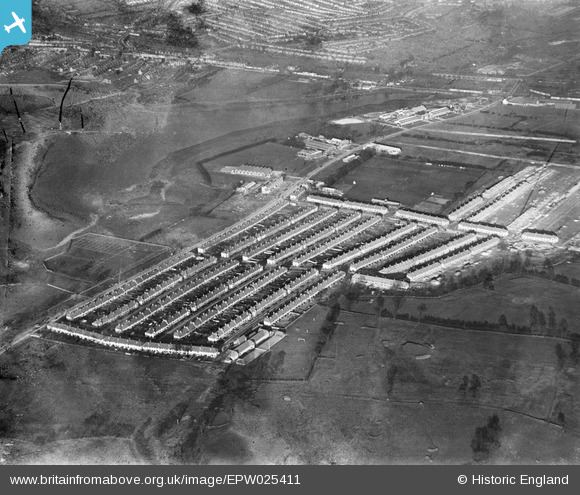
EPW025411 ENGLAND (1928). A new housing estate on the North Circular Road by the Brent Reservoir, Dollis Hill, 1928. This image has been produced from a damaged negative.
© Copyright OpenStreetMap contributors and licensed by the OpenStreetMap Foundation. 2024. Cartography is licensed as CC BY-SA.
Nearby Images (13)
EPW025411

EPW025410

EPW025396

EPW025415

EPW021257

EPW025417

EPW025398

EPW025414

EPW025412

EPW025416

EPW025397

EPW025413

EPW032178

Details
| Title | [EPW025411] A new housing estate on the North Circular Road by the Brent Reservoir, Dollis Hill, 1928. This image has been produced from a damaged negative. |
| Reference | EPW025411 |
| Date | 9-November-1928 |
| Link | |
| Place name | DOLLIS HILL |
| Parish | |
| District | |
| Country | ENGLAND |
| Easting / Northing | 521850, 186778 |
| Longitude / Latitude | -0.24177851615841, 51.566218485854 |
| National Grid Reference | TQ219868 |
Pins
Be the first to add a comment to this image!