
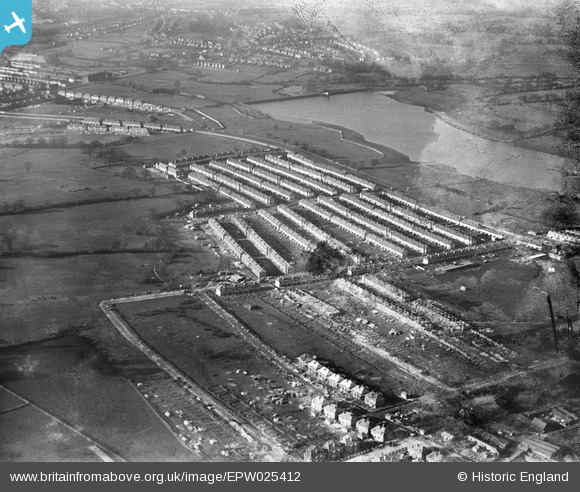
EPW025412 ENGLAND (1928). A new housing estate on the North Circular Road by the Brent Reservoir, Dollis Hill, 1928
© Copyright OpenStreetMap contributors and licensed by the OpenStreetMap Foundation. 2024. Cartography is licensed as CC BY-SA.
Nearby Images (12)
EPW025412

EPW021257

EPW025415

EPW025413

EPW025416

EPW025411

EPW025410

EPW025399

EPW025396

EPW025398

EPW025397

EPW025417

Details
| Title | [EPW025412] A new housing estate on the North Circular Road by the Brent Reservoir, Dollis Hill, 1928 |
| Reference | EPW025412 |
| Date | 9-November-1928 |
| Link | |
| Place name | DOLLIS HILL |
| Parish | |
| District | |
| Country | ENGLAND |
| Easting / Northing | 521954, 186661 |
| Longitude / Latitude | -0.24031922784753, 51.56514438457 |
| National Grid Reference | TQ220867 |
Pins
Be the first to add a comment to this image!