
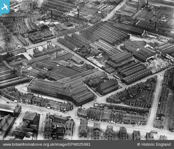
EPW025981 ENGLAND (1929). The George Mann and Co Engineering Works and St Silas' Church, Hunslet, 1929
© Copyright OpenStreetMap contributors and licensed by the OpenStreetMap Foundation. 2024. Cartography is licensed as CC BY-SA.
Nearby Images (19)
EPW025981

EPW025979

EPW025982

EPW026001

EPW026002

EPW025976

EPW025977

EPW025978

EPW025987

EPW025980

EPW025983

EPW025986

EPW025985

EPW025984

EPW028907

EPW025988

EPW028904

EPW028905

EPW028906

Details
| Title | [EPW025981] The George Mann and Co Engineering Works and St Silas' Church, Hunslet, 1929 |
| Reference | EPW025981 |
| Date | 11-April-1929 |
| Link | |
| Place name | HUNSLET |
| Parish | |
| District | |
| Country | ENGLAND |
| Easting / Northing | 431068, 432174 |
| Longitude / Latitude | -1.5284200377561, 53.784744817843 |
| National Grid Reference | SE311322 |
Pins
 Class31 |
Monday 25th of February 2013 03:06:49 PM | |
Class31 |
Monday 25th of February 2013 02:04:44 PM | |
Class31 |
Monday 25th of February 2013 01:34:20 PM | |
Class31 |
Monday 25th of February 2013 01:19:33 PM | |
Class31 |
Monday 25th of February 2013 12:51:32 PM | |
Class31 |
Monday 25th of February 2013 11:19:12 AM | |
Class31 |
Sunday 24th of February 2013 11:08:46 PM | |
Class31 |
Sunday 24th of February 2013 10:54:28 PM | |
Class31 |
Sunday 24th of February 2013 10:43:17 PM | |
Class31 |
Sunday 24th of February 2013 09:54:44 PM | |
Class31 |
Sunday 24th of February 2013 09:43:00 PM |